The post Russell Tavern and George Washington October, 1794 appeared first on Gettysburg Daily.
]]>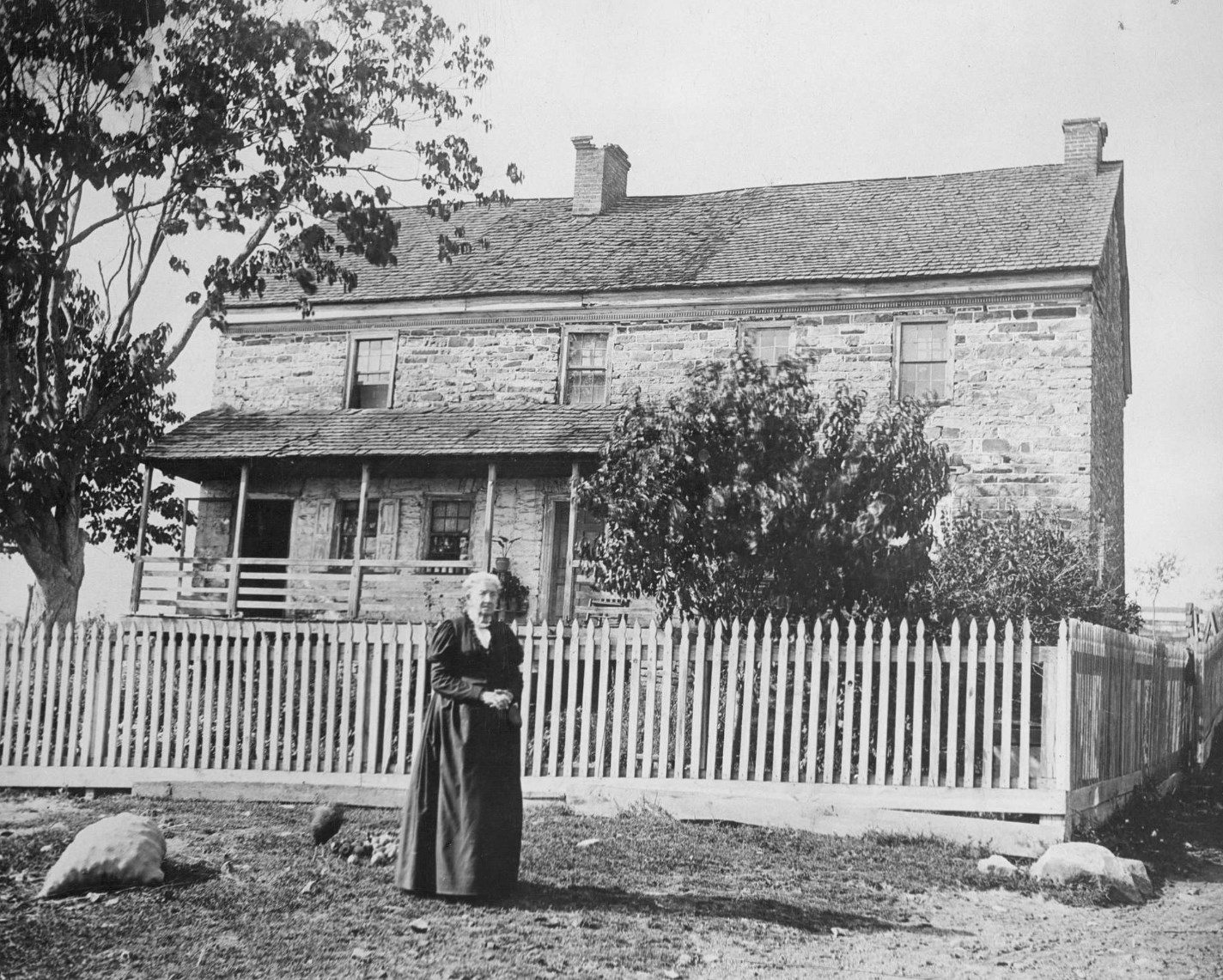
Russell Tavern located in Adams County, Pennsylvania, is most known for being the location where George Washington stopped in 1794. Washington was on his way back to Philadelphia, then the Capital of the United States, after he had led forces to put down the “Whiskey Rebellion” in western Pennsylvania. Standing in front of the structure is onetime resident Harriet Hamilton Bayly (1820-1904), the great-granddaughter of tavern owner Joshua Russell (circa 1733-1805). This image was taken facing north by northwest circa 1890. It is courtesy of the Adams County Historical Society.
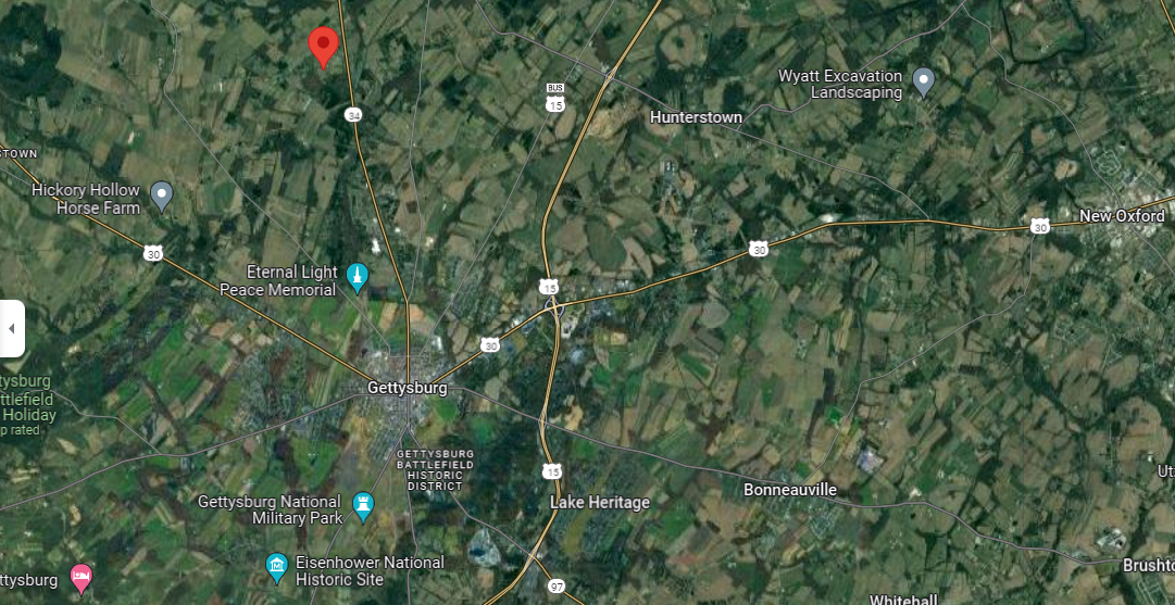
Russell Tavern is located approximately five miles north of the Borough of Gettysburg. Its location is indicated by the red marker. This image is courtesy of google.com/maps. It was accessed on August 23, 2024.
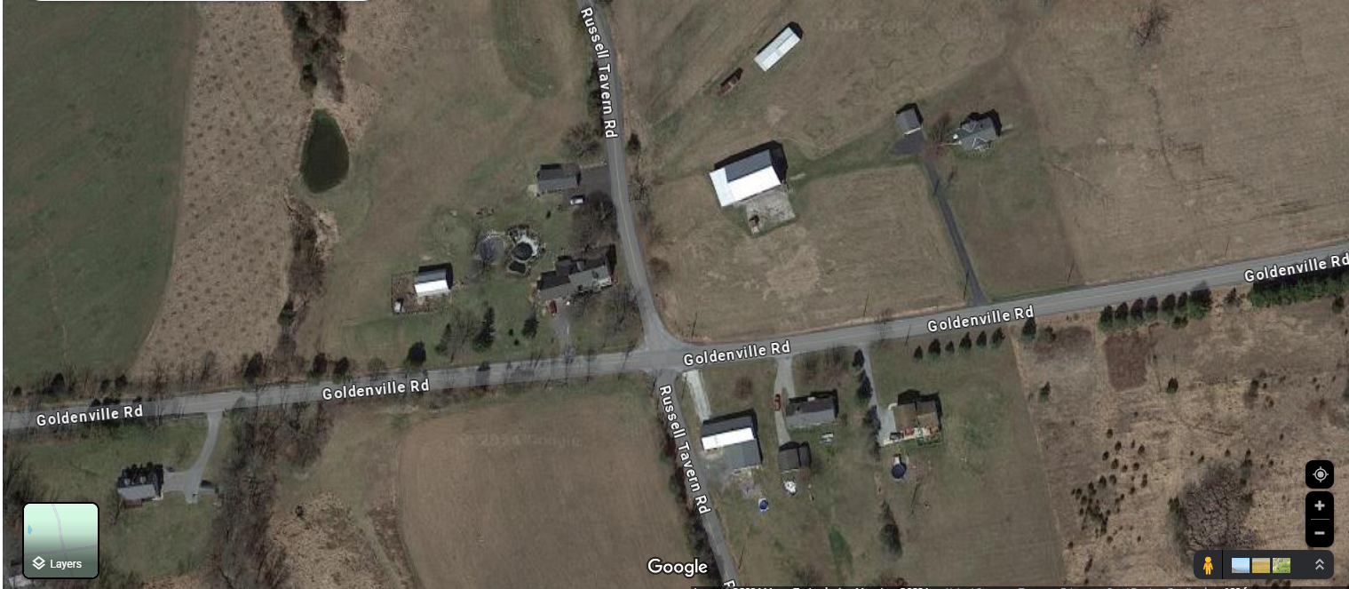
Russell Tavern is located at 1000 Russell Tavern Road at the intersection of Russell Tavern Road and Goldenville Road. It is located in the northwest section of that intersection. The Goldenville Road in 1794 was the Black Gap’s Road. The Russell Tavern Road in 1794 was a Gettysburg-Shippensburg Road (but not the Shippensburg Road that today goes through Mummasburg). This image is courtesy of google.com/maps. It was accessed on June 17, 2024.
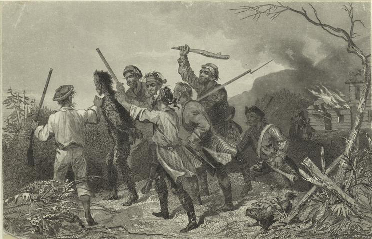
The Whiskey Rebellion challenged the power of the new federal government to collect taxes. The image is titled “Tarring and Feathering an Excise Officer.” The image was created by engraver John Rogers (1808-1888) circa 1863 for the book History of American Conspiracies 1760-1860 by Orville James Victor. The book was published in 1863. The image is on page 213. This image is courtesy of the New York Public Library.
To raise money for the federal government, Secretary of the Treasury Alexander Hamilton (circa 1755-1804) began two types of taxes, an import tax (tariff) and an excise tax. This image was created by John Trumbull (1756-1843) in 1792. This image is courtesy of Wikimedia Commons.
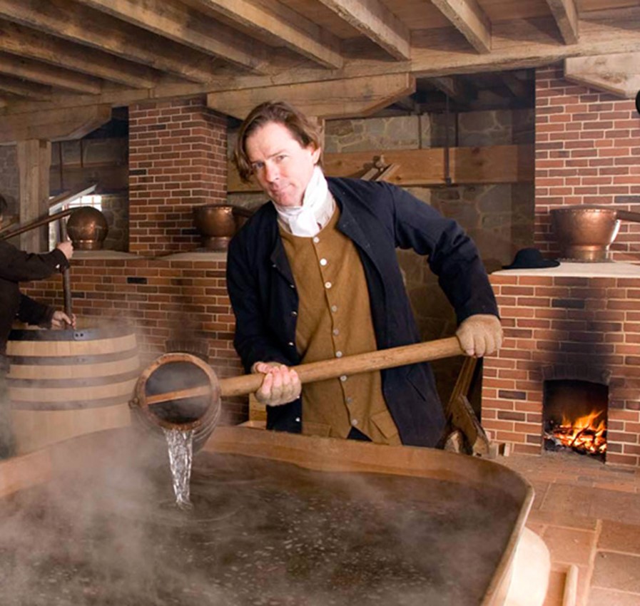
An excise tax is a tax placed on goods made, sold, and used within a country… like whiskey. This image is courtesy of mountvernon.org. It was accessed in 2012.
In 1794 farmers in western Pennsylvania were angry over the excise tax on whiskey. Approximately 6000 farmers and local militia gathered at Braddock’s Field in Allegheny County, Pennsylvania at the beginning of August, 1794. British General Edwin Braddock’s forces had been defeated here on July 9, 1755 during the French and Indian War. This image was created by Gottlieb Daniel Paul Weber (1823-1916) in 1854. It is titled “Braddock’s Field.” This image is courtesy of Wikimedia Commons. It was accessed on August 25, 2024.
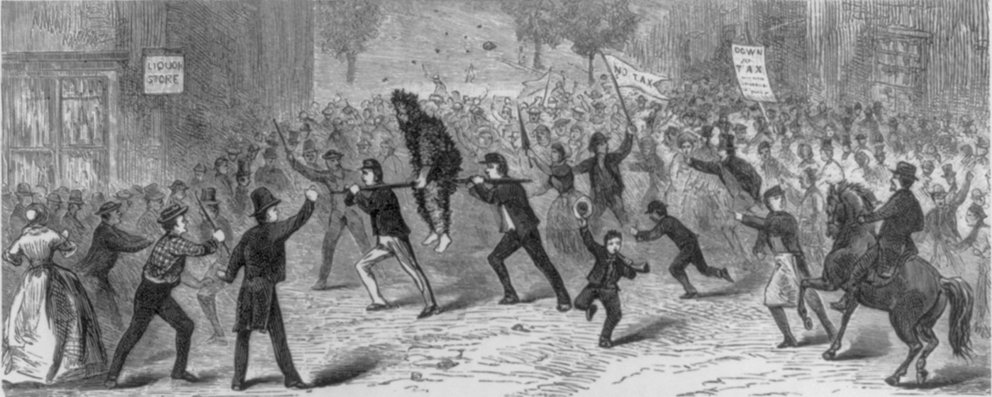
The farmers refused to pay the tax on whiskey. This image is titled “Famous Whiskey Insurrection in Pennsylvania.” The figures are not exactly wearing circa 1794 clothes. This image was created circa 1876 for the publication Our First Century: Being a Popular Descriptive Portraiture of the One Hundred Great and Memorable Events of Perpetual Interest In the History of Our Country… by Richard Miller Devens. The book was published in 1876. The image is found on page 161. This image is courtesy of the Library of Congress, and was accessed August 25, 2024.
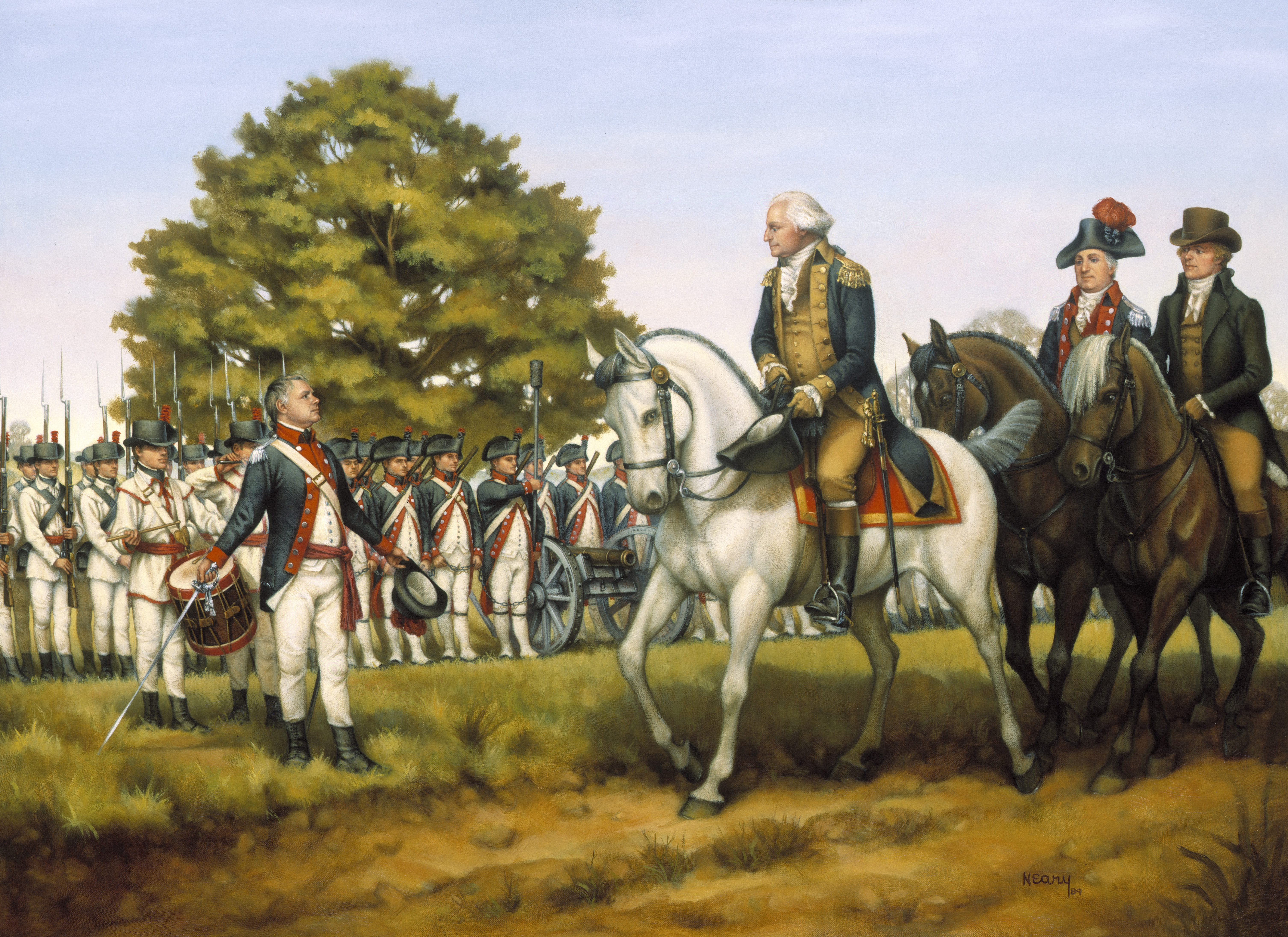
President George Washington personally led troops towards that area to put down the rebellion. This image, titled “To Execute the Laws of the Union,” was created in 2004 for the National Guard series of Heritage Paintings. This image shows Washington reviewing New Jersey soldiers in Harrisburg, Pennsylvania on October 3, 1794. This image is courtesy of Wikimedia Commons.
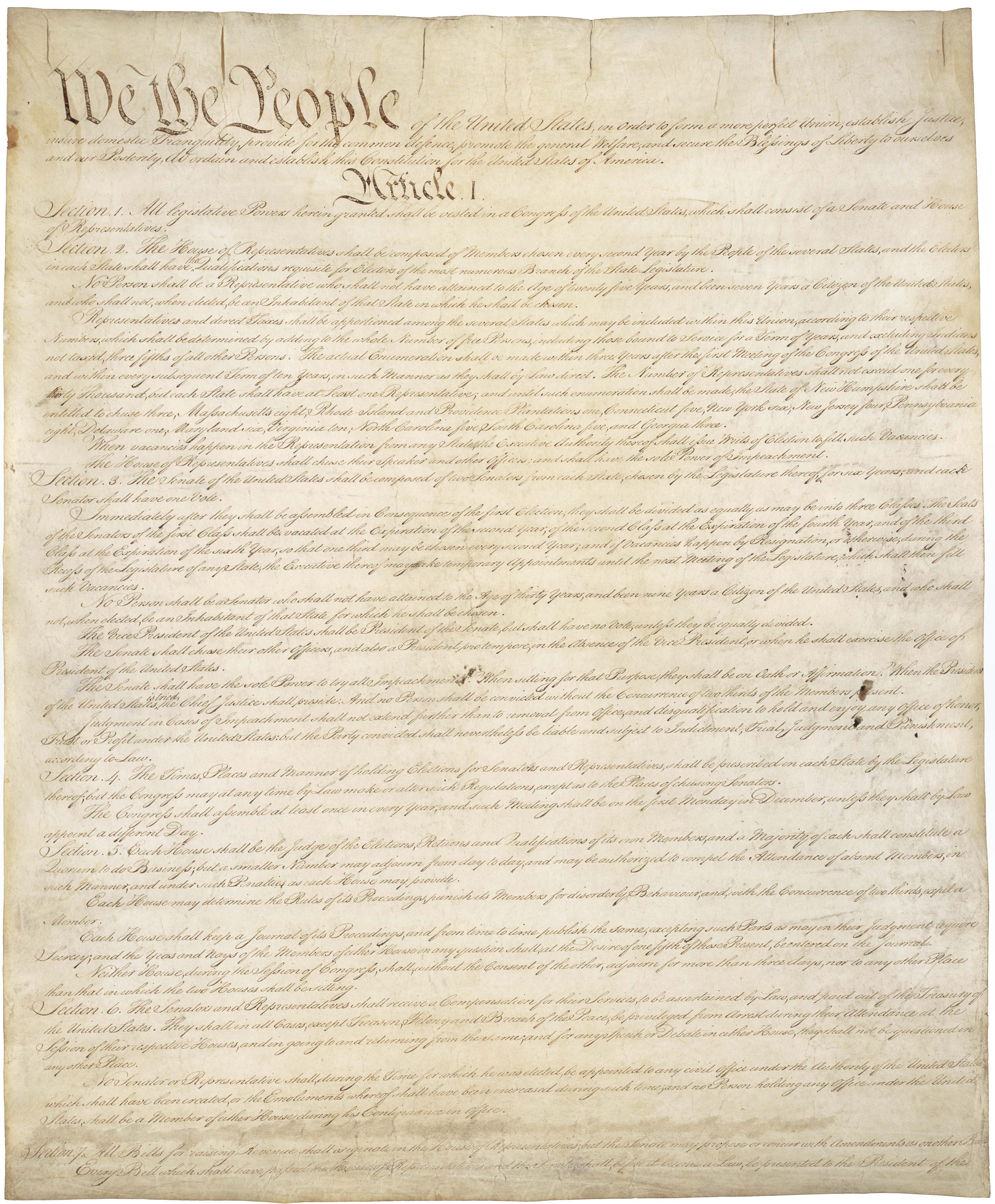
One of Washington’s main goals was to assure citizens of the power of the new United States government. The current United States Constitution was approved by delegates in Philadelphia in 1787. It became the law of the land in 1789 when approved by New Hampshire (the ninth state to ratify the Constitution). Rhode Island was the 13th state to approve the Constitution in 1790. This image is courtesy of the National Archives.

Washington reviewed militia from Pennsylvania and New Jersey in Carlisle, Pennsylvania. He then rode to Cumberland, Maryland, and reviewed militia from Virginia and Maryland. During his time as president, Washington owned two white horses, Prescott and Jackson. Prescott was described as “a fine parade horse, purely white, and sixteen hands high.” This image was created circa 1795 by Frederick Kemmelmeyer (1755-1821). It is titled “Washington Reviewing the Western Army at Fort Cumberland, Maryland,” and shows Washington reviewing militia there on October 16, 1794. It is courtesy of the Metropolitan Museum of Art. The information on Washington’s horses is from George Washington’s Mount Vernon.
The militia moved westward. President Washington and the first 3000 soldiers reached Bedford, Pennsylvania on October 19, 1794. Approximately 12,000 militia had been raised between those formed at Carlisle, Pennsylvania, and those formed at Cumberland, Maryland. This image is titled “Capture of the Whiskey-Tax Collectors.” It was created for an American history book in 1876.
By the time Washington reached Bedford, it had become obvious that those in rebellion had fled or had decided not to resist. This image is titled “1794. The Whiskey Rebellion.” The image was created in 2015 by the Federal Highway Administration. The image is courtesy of Wikimedia Commons.
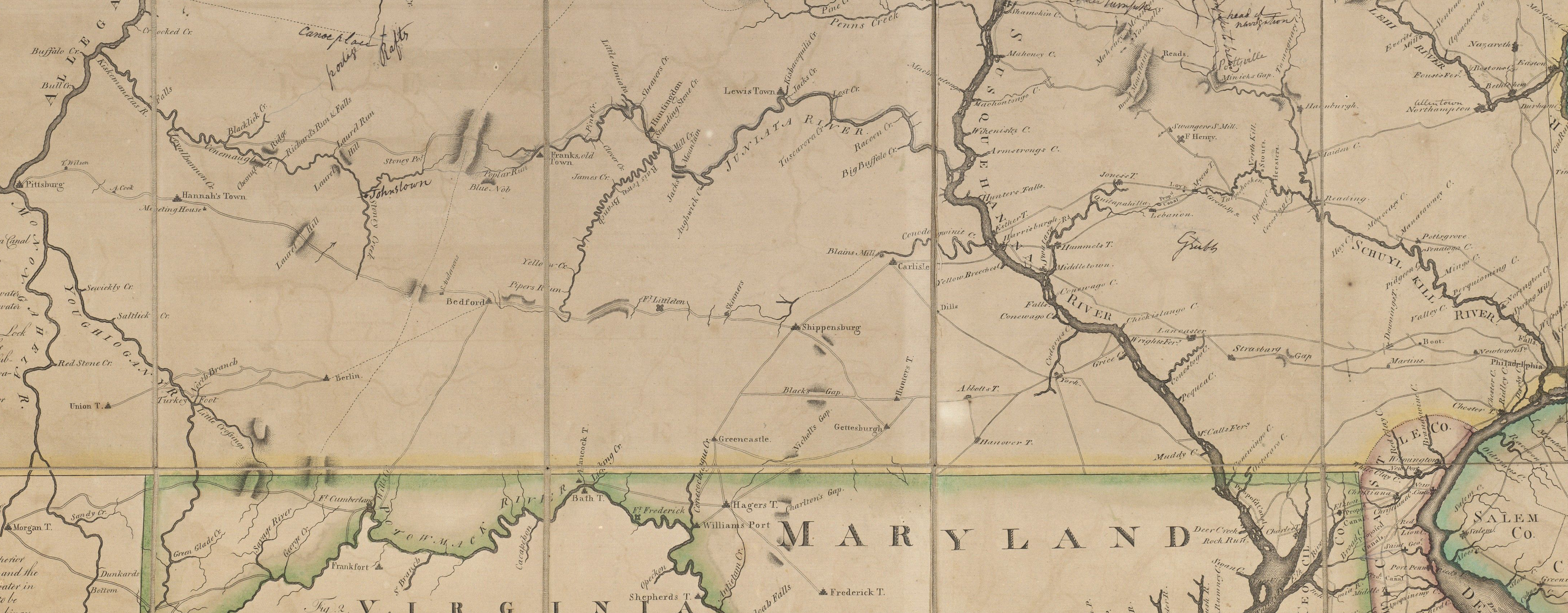
While part of the army continued towards Pittsburgh, and would arrest approximately 150 people (most of them were pardoned), Washington left Bedford on October 21, 1794 and headed back to Philadelphia. This cropped image is from a map titled “A Map Exhibiting a General View of the Roads and Inland Navigation of Pennsylvania, and Part of the Adjacent States.” The map was created by John Adlum (1759-1836) in 1791. The map is courtesy of the Beinecke Rare Book and Manuscript Library at Yale University.

Although the diary for this time period is unclear, the editors of President Washington’s diaries at the National Archives believe that the route he took back to Philadelphia was from “Bedford to Chambersburg, from Chambersburg to York, and then to Lancaster…” That route would take him through Black’s Gap (today’s Cashtown Gap) and through Hunterstown. This cropped image is from a map titled “A Map Exhibiting a General View of the Roads and Inland Navigation of Pennsylvania, and Part of the Adjacent States.” The map was created by John Adlum (1759-1836) in 1791. The map is courtesy of the Beinecke Rare Book and Manuscript Library at Yale University.

Russell’s Tavern is located at the small red dot at the intersection of the Black’s Gap Road and the Gettysburg-Shippensburg Road. It is believed that President Washington reached Russell Tavern on October 24, 1794. It is not known exactly how many people accompanied Washington on his trip back to Philadelphia, but he noted in his diary on October 26th that he had reached Wright’s Ferry on the Susquehanna River “without accident to man, horse, or carriage.” He would have had at least a driver for his carriage, and a footman for his carriage. Russell family descendants stated that he was accompanied by “four or five aides and his military secretary…” (Article by Alice Black on Russell Tavern in 1935 Page 14. A copy is at the Adams County Historical Society). This cropped image is from a map titled “A Map Exhibiting a General View of the Roads and Inland Navigation of Pennsylvania, and Part of the Adjacent States.” The map was created by John Adlum (1759-1836) in 1791. The map is courtesy of the Beinecke Rare Book and Manuscript Library at Yale University.
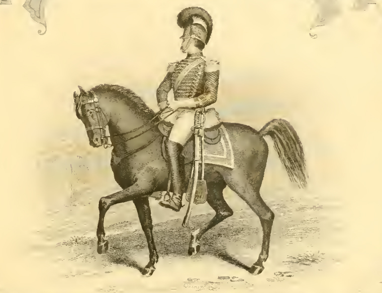
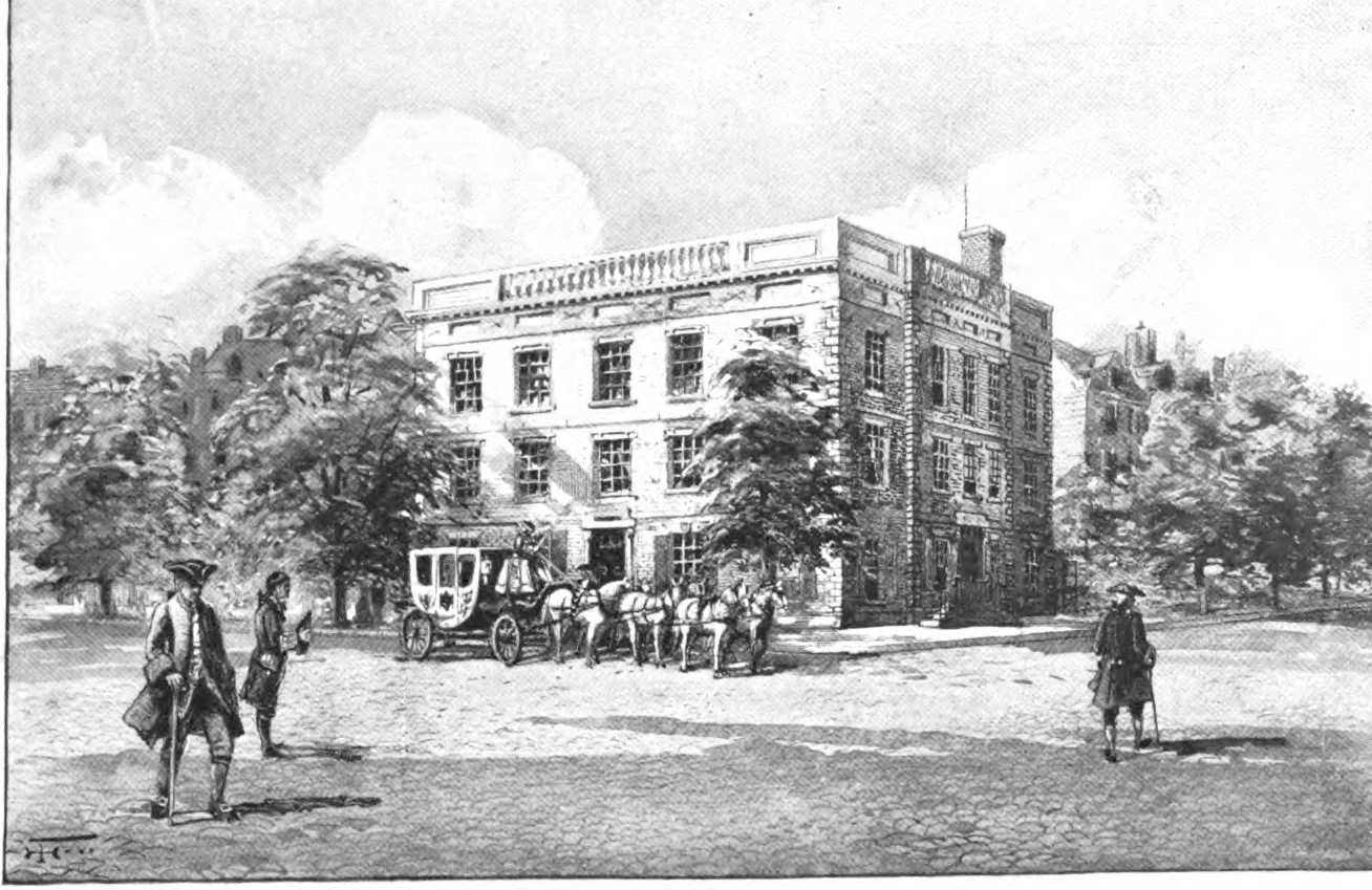
Adams County resident Thomas Craig, who supposedly was 104 years old when he died, told of how Washington passed by his house “on what was known as the Philadelphia road– that Washington rode in a great carriage, guarded by light horse, etc…” (Gettysburg Compiler November 30, 1877 page 2 column 5). It is not known who this group of light horse was. Unless a few members of the First Troop Philadelphia City Cavalry returned with Washington in October, 1794, it was not this unit. The First Philadelphia City Cavalry had guarded Washington as he met soldiers in Carlisle on their way to Bedford. They state in the unit’s history that the unit did not return to Philadelphia until December 25, 1794. It seems to this editor if some of them were required to accompany the President of the United States back to Philadelphia, it would have been mentioned in their unit history. This image was taken from a frontispiece of History of the First Troop Philadelphia City Cavalry printed by Hallowell & Company in Philadelphia in 1874.
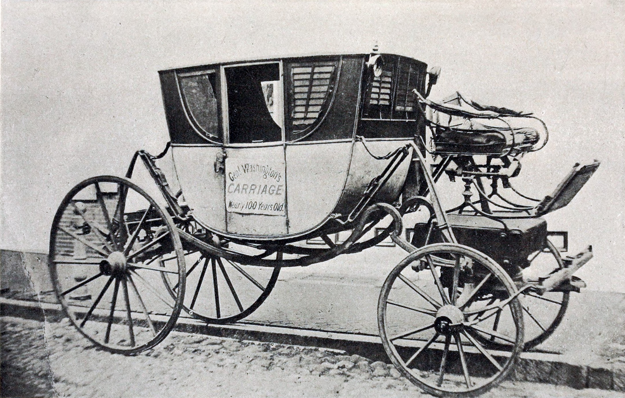
This is a photograph of the “Powel Carriage” when it was on display for the 1876 Philadelphia Exposition. Although made identical to Washington’s carriage by the same carriage maker in England, the “Powel Carriage” belonged to Samuel Powel, a one-time Mayor of Philadelphia. Later owners of the carriage tried to present it as Washington’s carriage even though this carriage was originally a reddish color, and had the Powel crest on the door. This Powel carriage is now on display at George Washington’s home at Mount Vernon, Virginia. This image was published in Mary Stevens Beall’s The Story of the Washington Coachee and of the Powel Coach which is now at Mount Vernon. It was published by Neale Publishing Company of Washington, D.C. in 1908. The image is facing page 64.
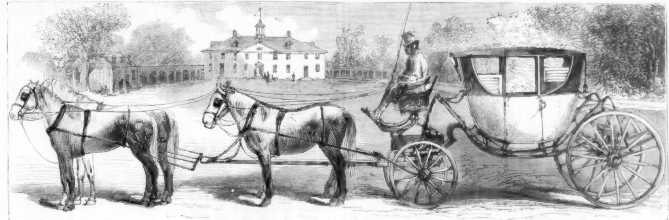
President Washington had three vehicles, all painted cream colored. In 1790 Washington wrote to a carriage maker to make sure that his state carriage was “neatly painted and highly varnished.” His carriages were known as the “white carriages.” One of the three carriages was a “post-chaise for traveling and the country, one a family coach; and another a chariot for state purposes.” The state carriage that he had in New York and in Philadelphia had oval glass windows in the front and back of the carriage. The carriage had paintings representing the four seasons represented by cupids on the front and back of the carriage, and also on the two doors. The paintings were on copper medallions each measuring 10″ X 8″. The four panels on the carriage (bottom left and bottom right on each side) displayed Washington’s crest/coat of arms. The state carriage, and the one that was most likely used during the Whiskey Rebellion, and at Russell Tavern eventually was sold to John F. Watson who was a resident of New Orleans. It was in storage on his property from 1804-1806. The carriage was falling apart, and eventually used as a henhouse. Watson wrote that during the Battle of New Orleans on January 8, 1815, it was used as part of the fortifications of the United States defensive line, and was completely destroyed by bullets and artillery shells during the battle. Later historians dispute that story of the carriage’s demise. The information on President Washington’s coaches were published in Mary Stevens Beall’s The Story of the Washington Coachee and of the Powel Coach which is now at Mount Vernon. It was published by Neale Publishing Company of Washington, D.C. in 1908. A summary of the findings on the carriages are found on pages 69-74. The image of the Powel Coach in front of Mount Vernon was published in Harpers Weekly on March 16, 1872. It was at the top of page 13/213.
Sometimes President Washington’s state carriage was pulled by four horses, and at other times it was pulled by six horses. Another of Washington’s white carriages eventually was purchased by Episcopal Bishop William Meade (1789-1862) of Richmond, Virginia (not a direct relation to Gettysburg’s Major-General George Gordon Meade). As it was falling apart, Bishop Meade eventually had it taken apart and gave away the parts as souvenirs. The third Washington white coach, made in France, was owned by Henry Dunlap Sr., a carriage builder in Philadelphia. Like Bishop Meade, this carriage was taken apart when it was too old, and the pieces were sold as relics. This information on President Washington’s coaches were published in Mary Stevens Beall’s The Story of the Washington Coachee and of the Powel Coach which is now at Mount Vernon. It was published by Neale Publishing Company of Washington, D.C. in 1908. A summary of the findings on the carriages are found on pages 69-74. This image of President Washington’s coach in front of the Franklin House at Franklin Square in New York City was published in Leila Herbert’s The First American: His Homes and his Households. The book was published by Harper and Brothers in New York City in 1900. The image was displayed after page 44.
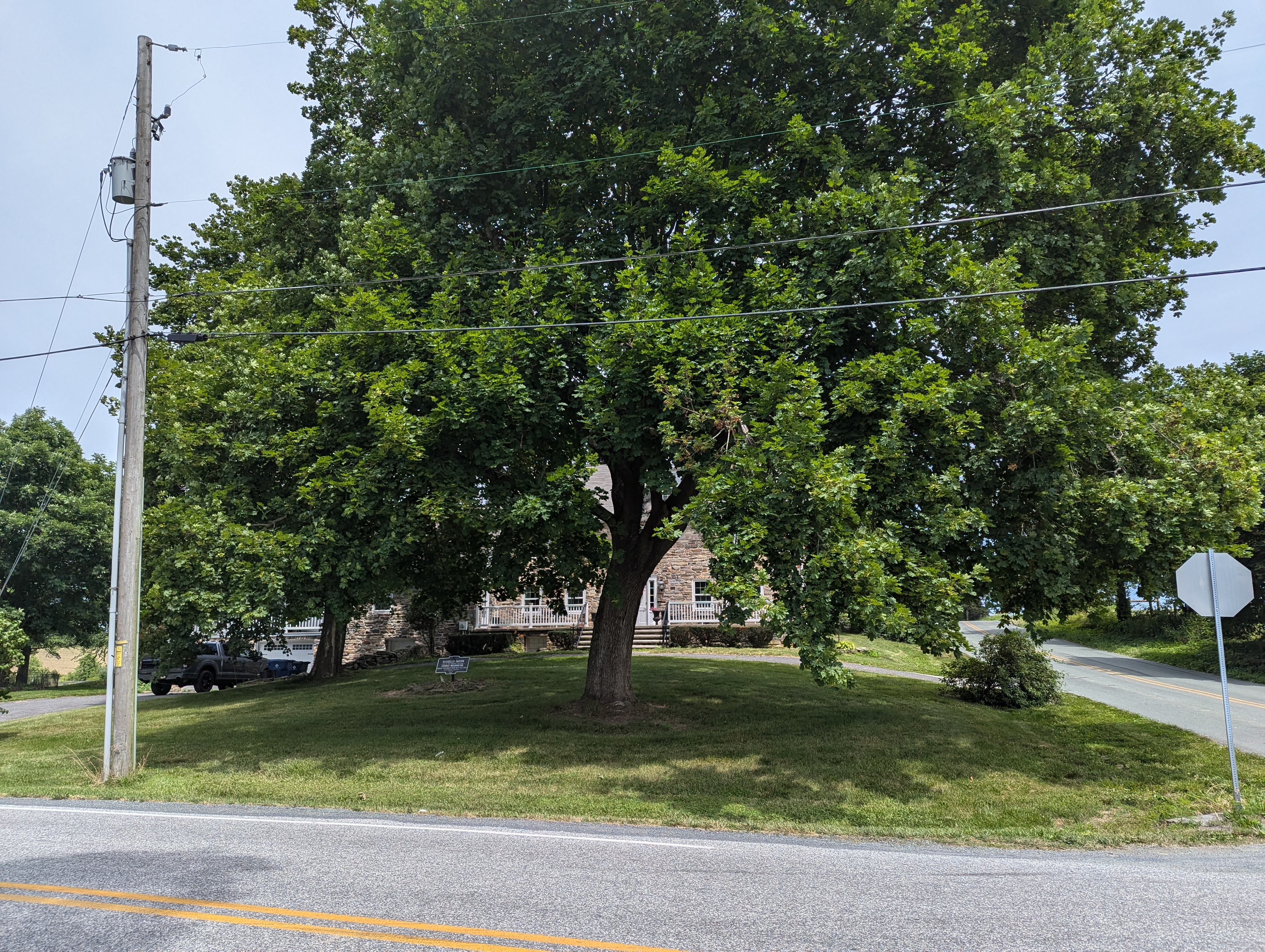
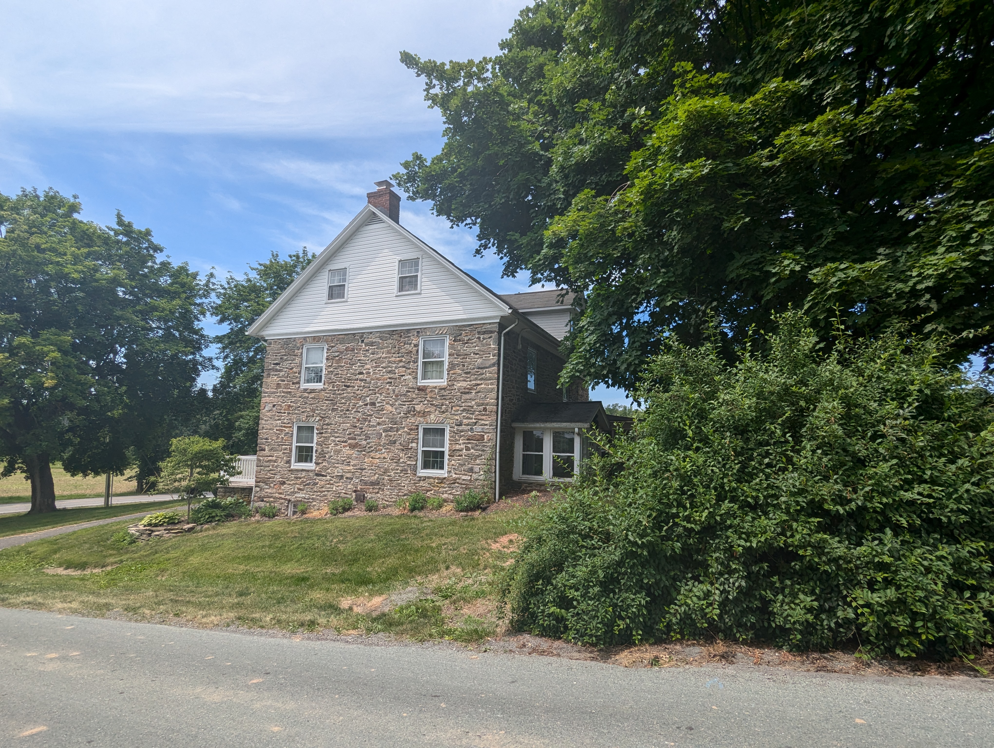
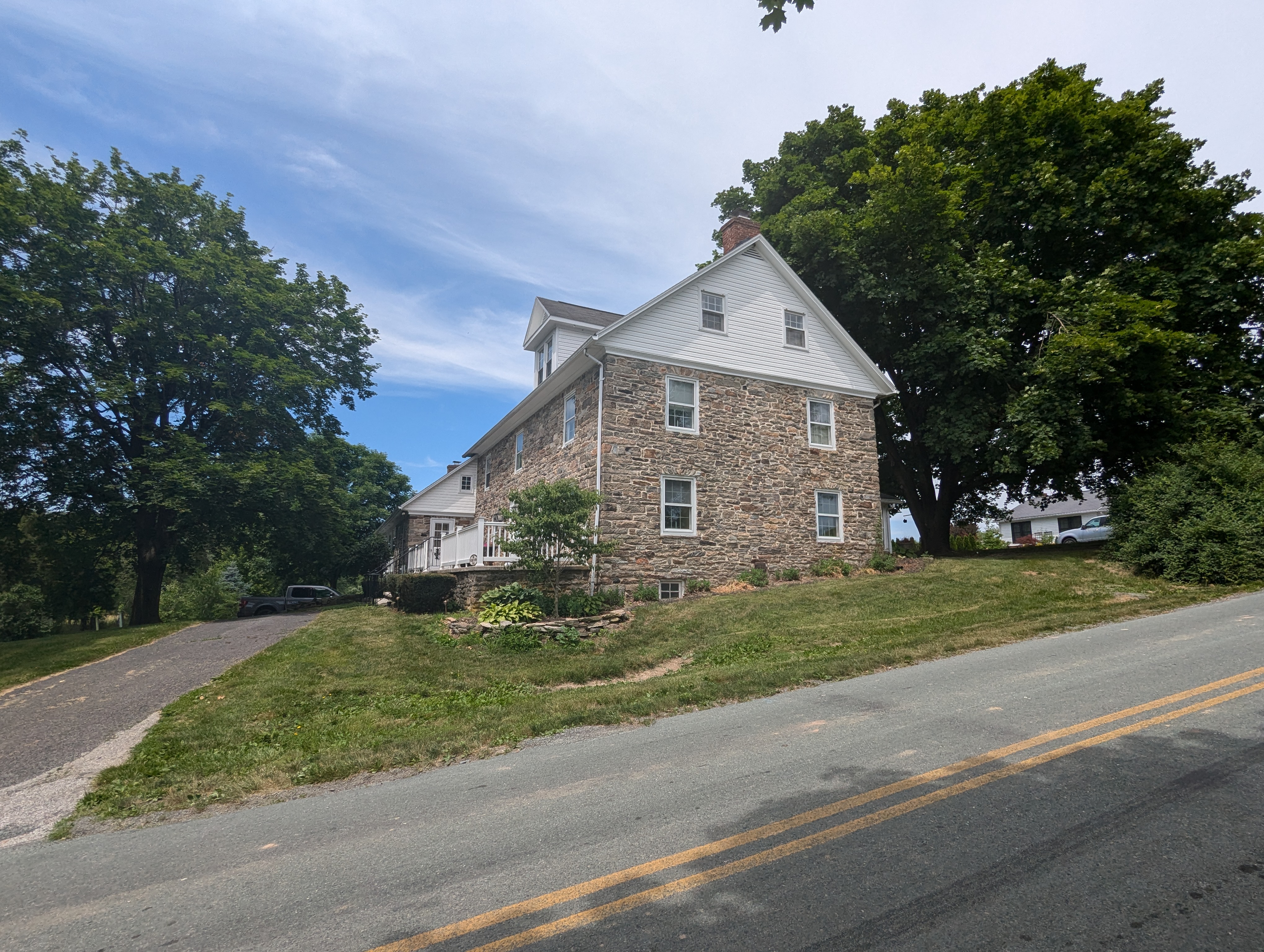
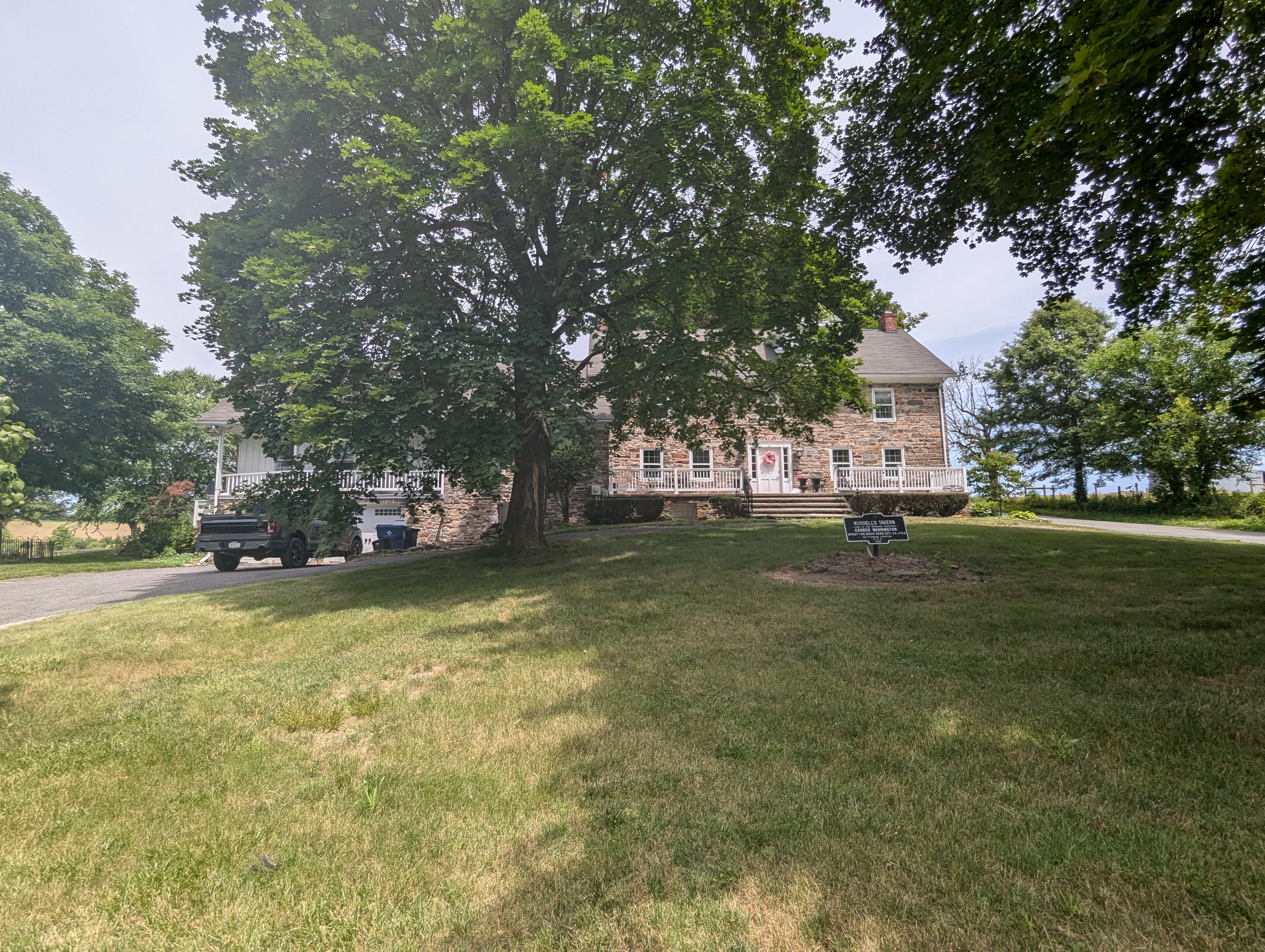
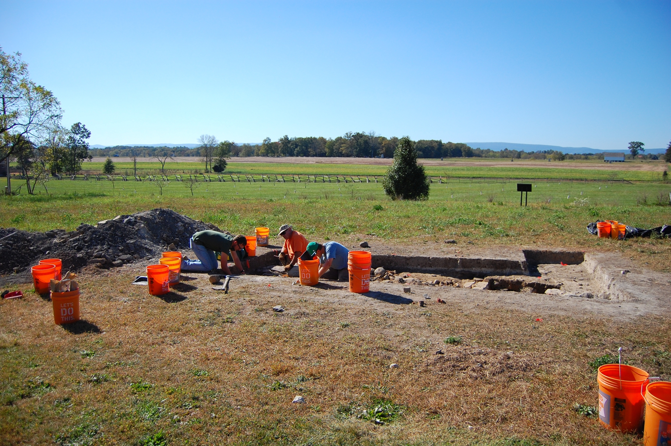
Today, if you don’t know what you’re looking for, it is easy to miss Russell Tavern, hidden by the large tree when the leaves are out. This image was taken facing north-northwest at approximately 12:00 PM on Sunday, June 16, 2024.
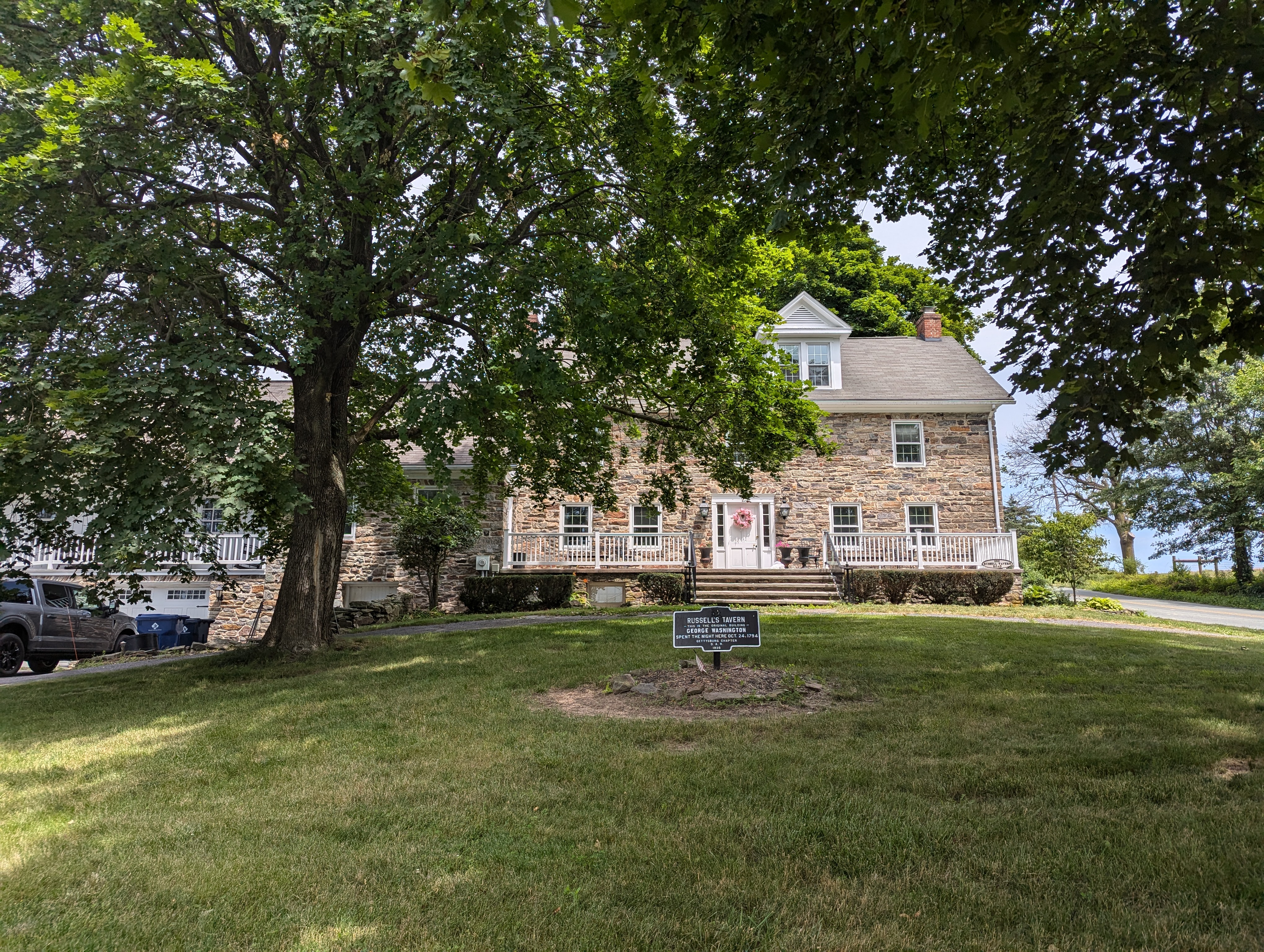
Russell Tavern was constructed in 1755. At least that is according to a date stone that used to be a part of the house, but which was removed following a fire. The information on Russell Tavern comes from the following files at the Adams County Historical Society: Russell Tavern File, Russell Family File. Carey Family File. This image was taken facing north-northwest at approximately 12:00 PM on Sunday, June 16, 2024.
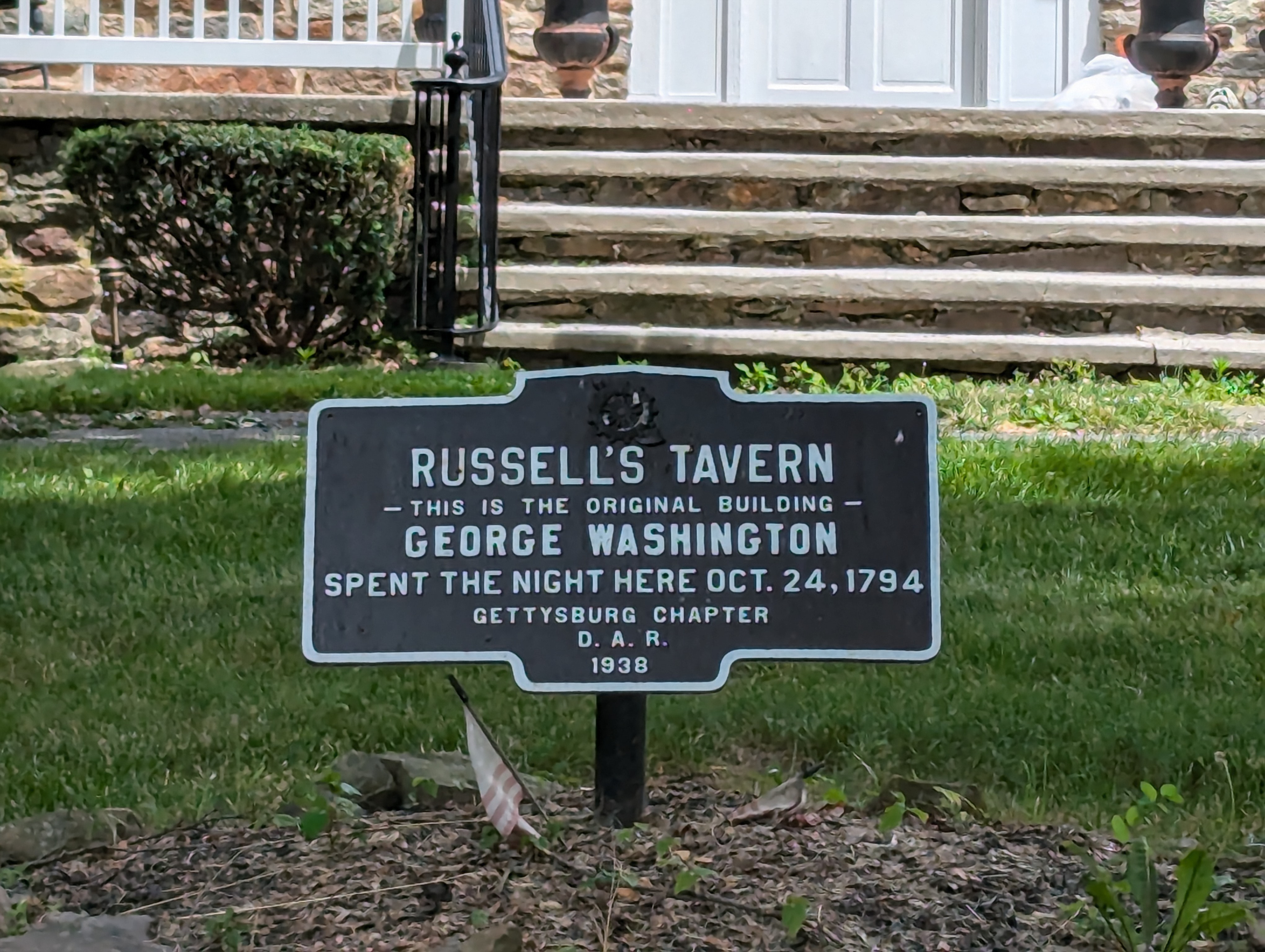
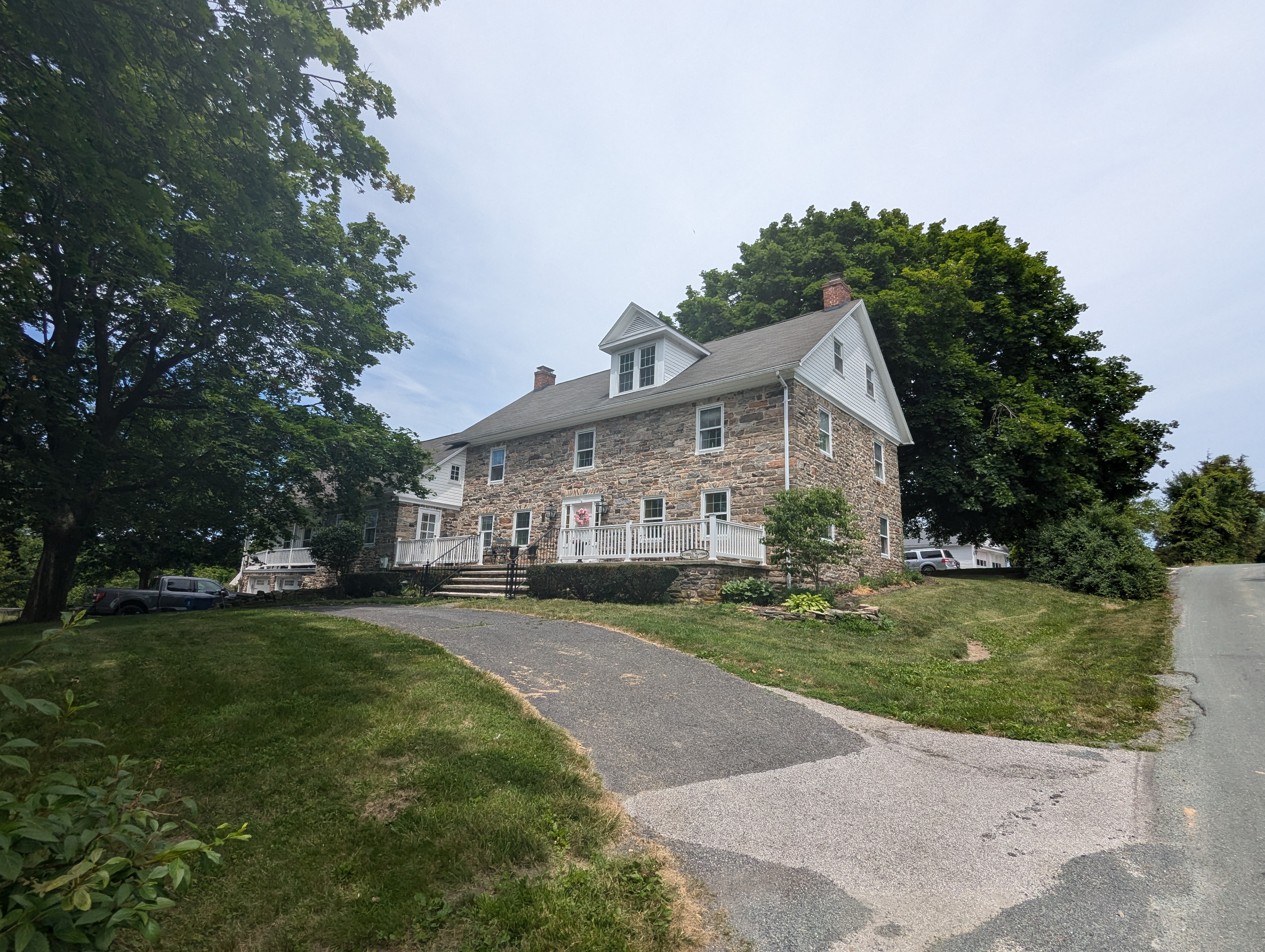
The historic marker in front of the house was dedicated on June 21, 1938 by the Gettysburg Chapter of the Daughters of the American Revolution. The information on Russell Tavern comes from the following files at the Adams County Historical Society: Russell Tavern File, Russell Family File. Carey Family File. This image was taken facing north-northwest at approximately 12:00 PM on Sunday, June 16, 2024.
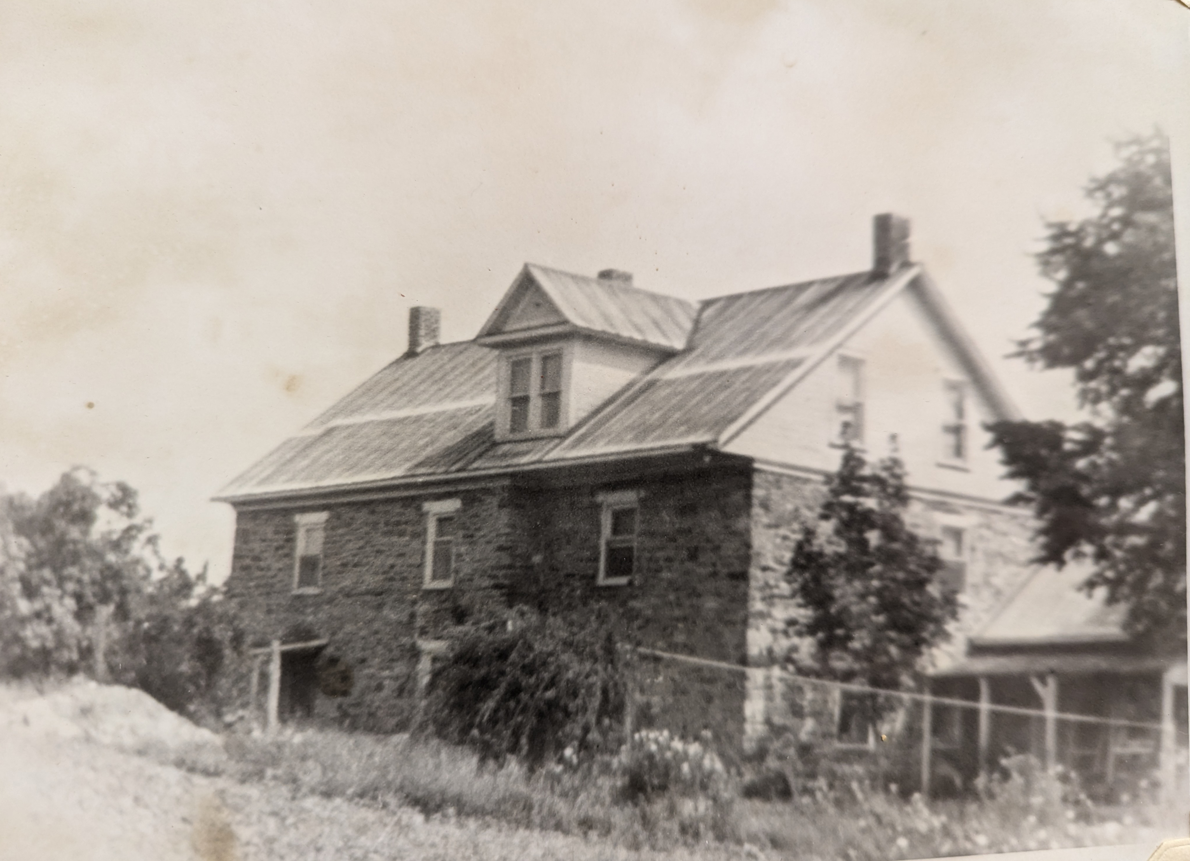
When Washington visited Russell Tavern, he and his four or five aides and military secretary were all probably lodged inside the structure. This image was taken facing east-southeast circa 1965 by Joyce Ann Nary, a student of Colonel Jacob Sheads at Gettysburg High School. The photographs that she took were part of a project on Russell Tavern that she submitted. A folder containing her project is at the Adams County Historical Society.
Were the driver, footman, and military personnel who accompanied President Washington housed somewhere outside the house or in one of the outbuildings? This image was taken facing southwest circa 1965 by Joyce Ann Nary, a student of Colonel Jacob Sheads at Gettysburg High School. The photographs that she took were part of a project on Russell Tavern that she submitted. A folder containing her project is at the Adams County Historical Society.
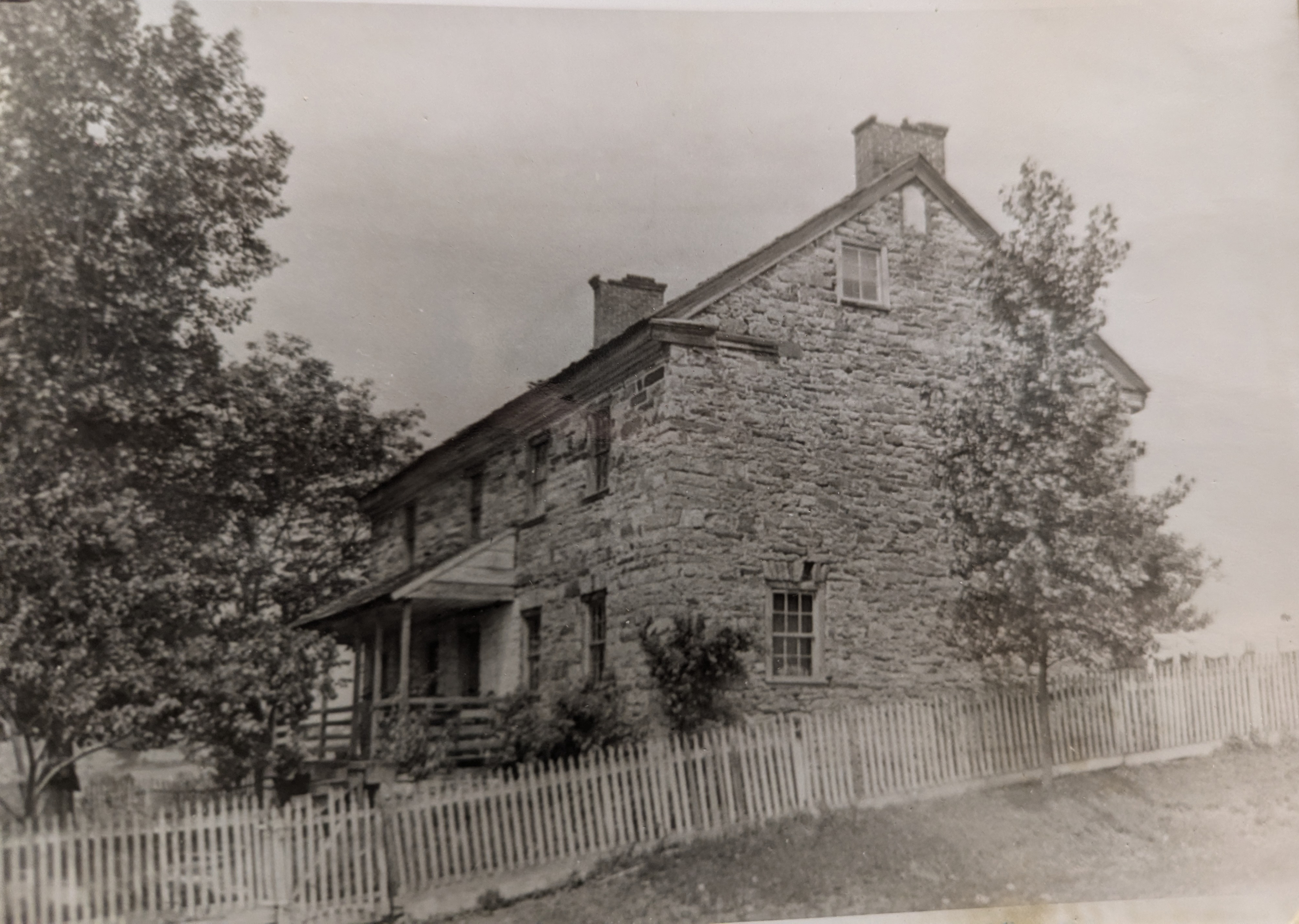
Descendants of the Russell family claimed that George Washington not only had a meal here, that he slept here. One story passed down through the family said there was a sick baby in the house at the time, and Washington had to go around the house in his stocking feet in order to not wake the baby. The Gettysburg-Shippensburg/Russell Tavern Road is in the foreground. The information on Russell Tavern comes from the following files at the Adams County Historical Society: Russell Tavern File, Russell Family File. Carey Family File. This image was taken facing west at approximately 12:00 PM on Sunday, June 16, 2024.
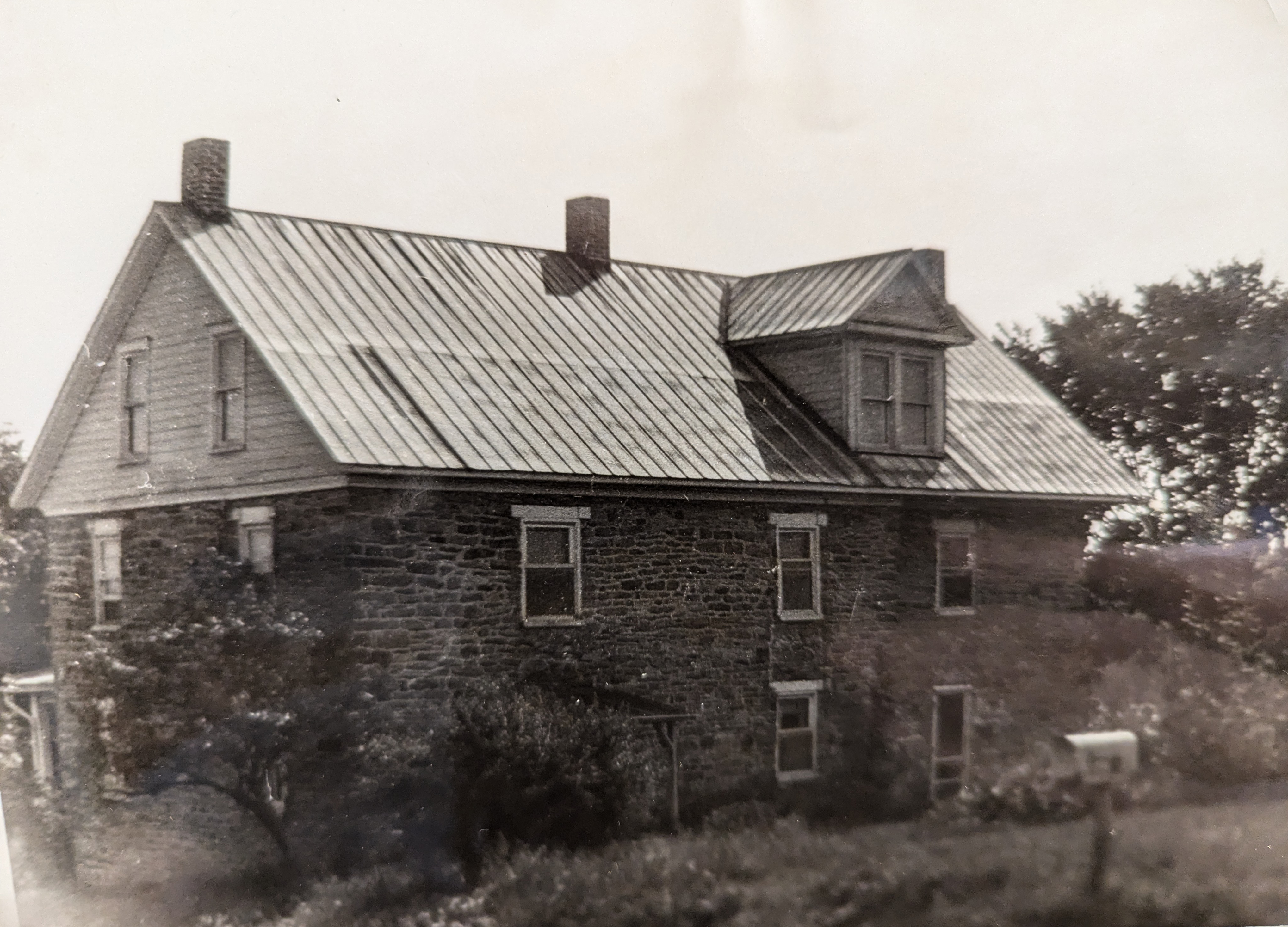
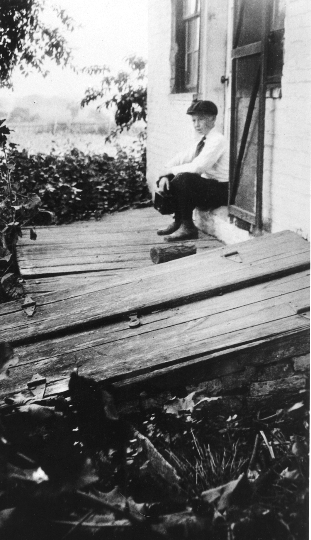
The date stone listing the year 1755 is the lighter colored stone at the top of the stone gable right below the chimney on this (east) side of the house. This photograph was taken facing west sometime prior to March 15, 1917. It is from the Joyce Ann Nary file folder at the Adams County Historical Society.
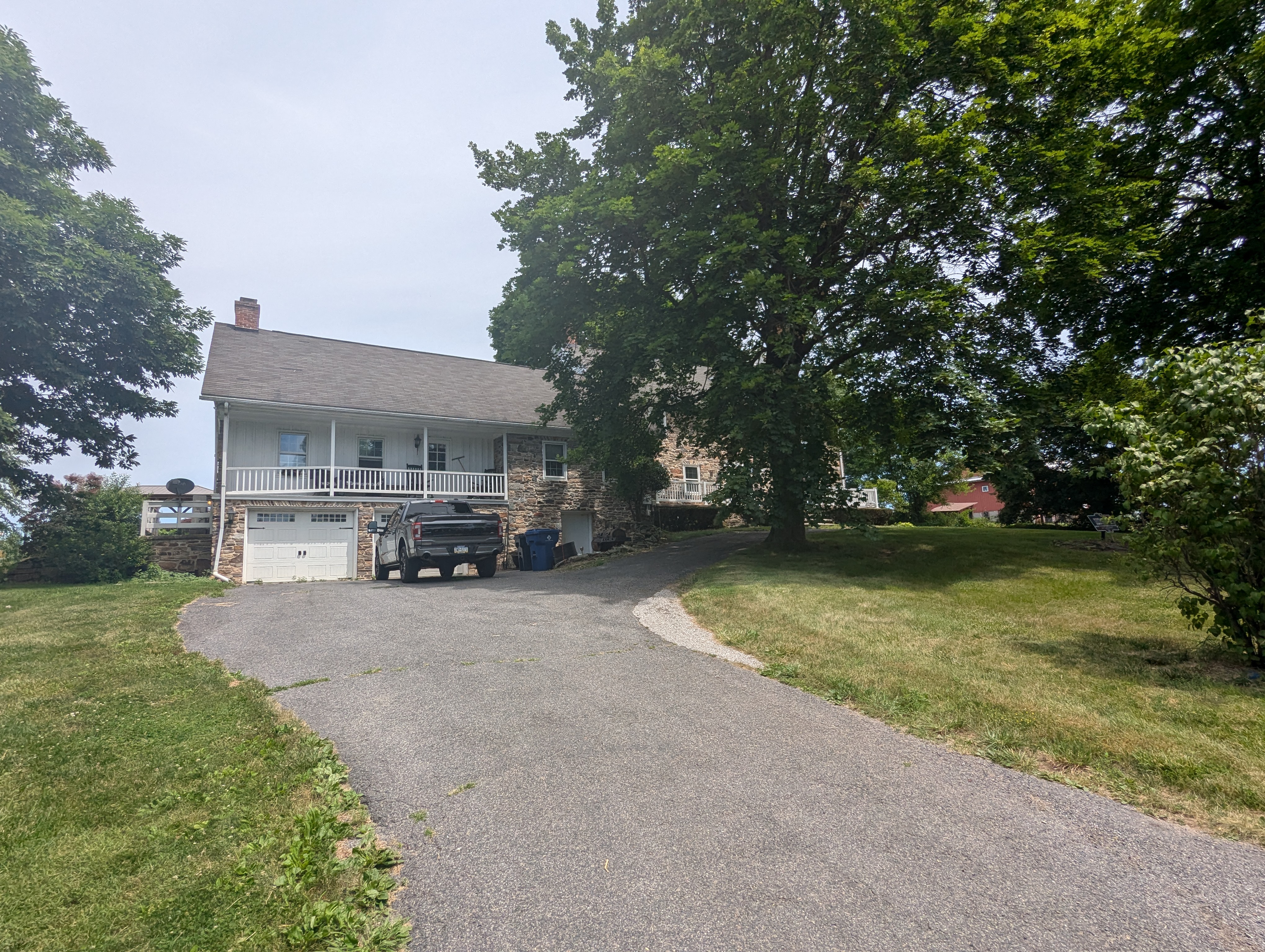
Today the stones and stone gable at the top of the house have been replaced by a wooden gable which has been painted white. The Gettysburg-Shippensburg/Russell Tavern Road is in the foreground. The information on Russell Tavern comes from the following files at the Adams County Historical Society: Russell Tavern File, Russell Family File. Carey Family File. This image was taken facing west at approximately 12:00 PM on Sunday, June 16, 2024.
Washington reached York Town (York), Pennsylvania on October 25, 1794 and crossed the Susquehanna River on October 26, 1794. Washington reached Philadelphia on October 28, 1794. The information on Russell Tavern comes from the following files at the Adams County Historical Society: Russell Tavern File, Russell Family File. Carey Family File. This image was taken facing northwest at approximately 12:00 PM on Sunday, June 16, 2024.
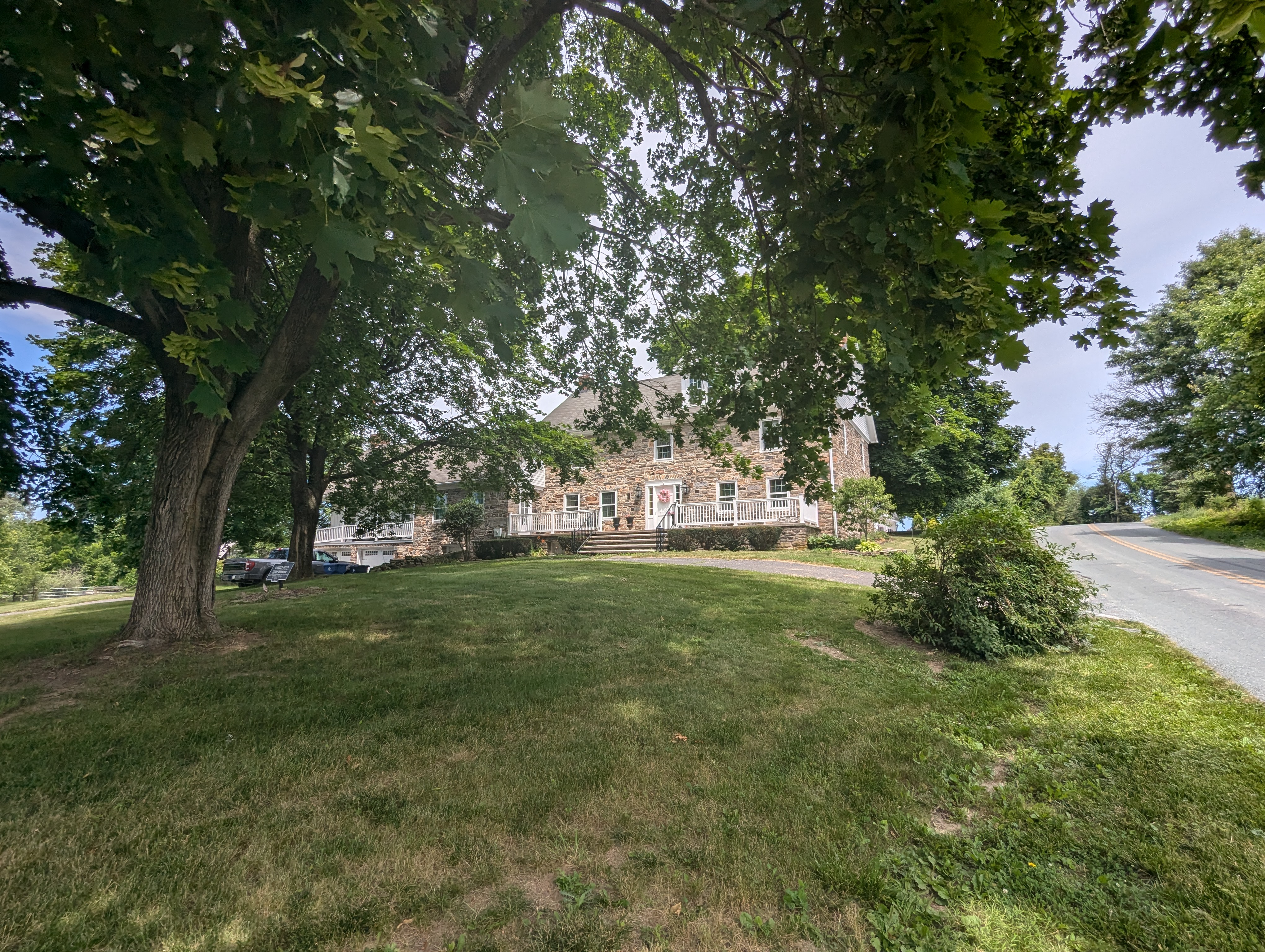
Joshua Russell, the owner of the tavern/inn, had a tavern license in 1781 (and could have had tavern licenses earlier). The information on Russell Tavern comes from the following files at the Adams County Historical Society: Russell Tavern File, Russell Family File. Carey Family File. This image was taken facing northwest at approximately 12:00 PM on Sunday, June 16, 2024.
According to the 1799 tax records for Franklin Township (Russell Tavern is now located in Butler Township), Joshua Russell was an innkeeper, owned 200 acres, a stone house, and a stone barn. The information on Russell Tavern comes from the following files at the Adams County Historical Society: Russell Tavern File, Russell Family File. Carey Family File. This image was taken facing northwest at approximately 12:00 PM on Sunday, June 16, 2024.
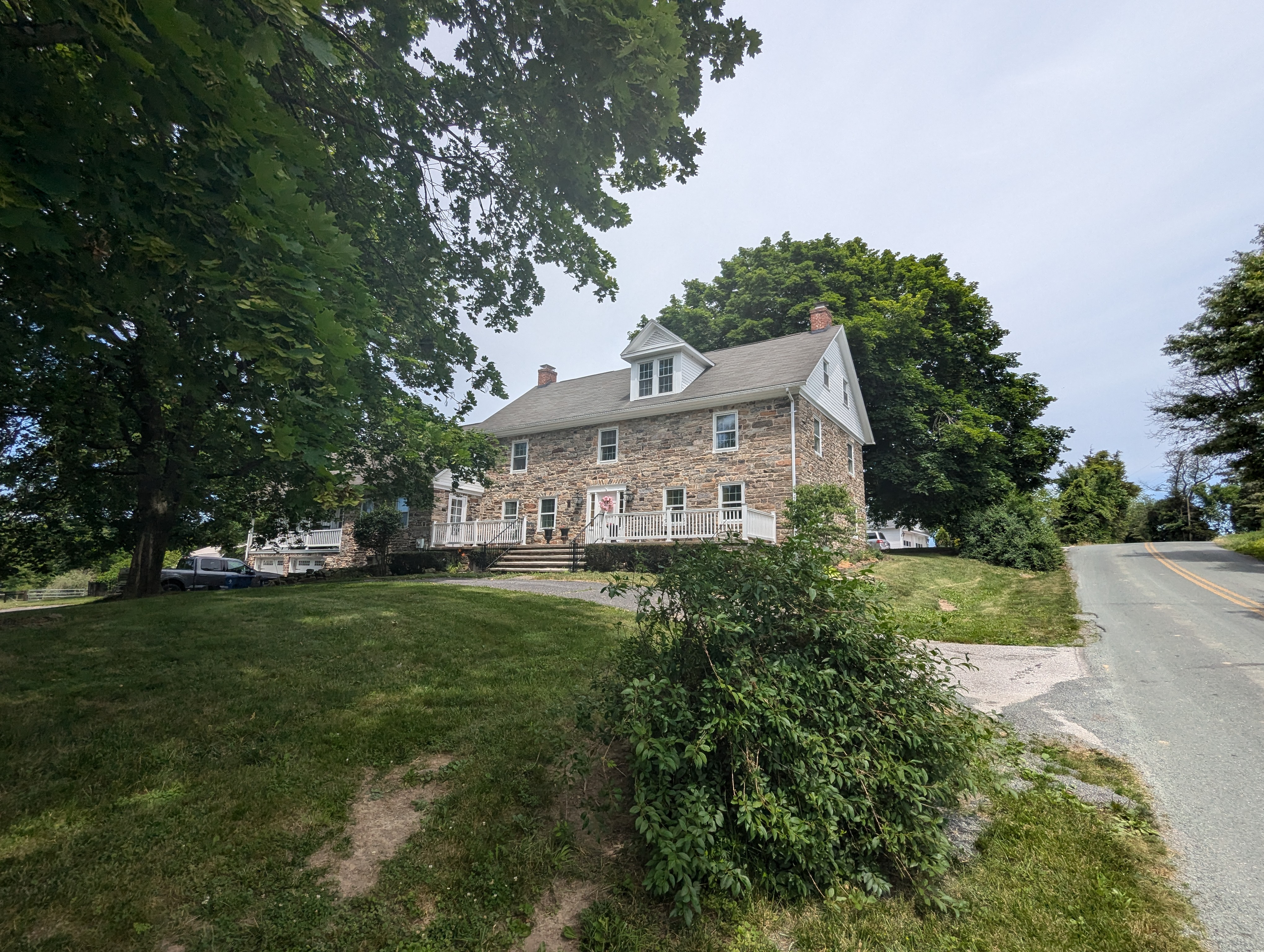
The tavern stayed in the Russell family until 1847. From 1847-1878 it belonged to Anthony Deardorff. From 1878-1892 it belonged to John Carey. From 1892 to 1894 it belonged to John McCullough. From 1894 until 1930, Russell Tavern belonged to Charles Carey. The information on Russell Tavern comes from the following files at the Adams County Historical Society: Russell Tavern File, Russell Family File. Carey Family File. This image was taken facing north-northwest at approximately 12:00 PM on Sunday, June 16, 2024.
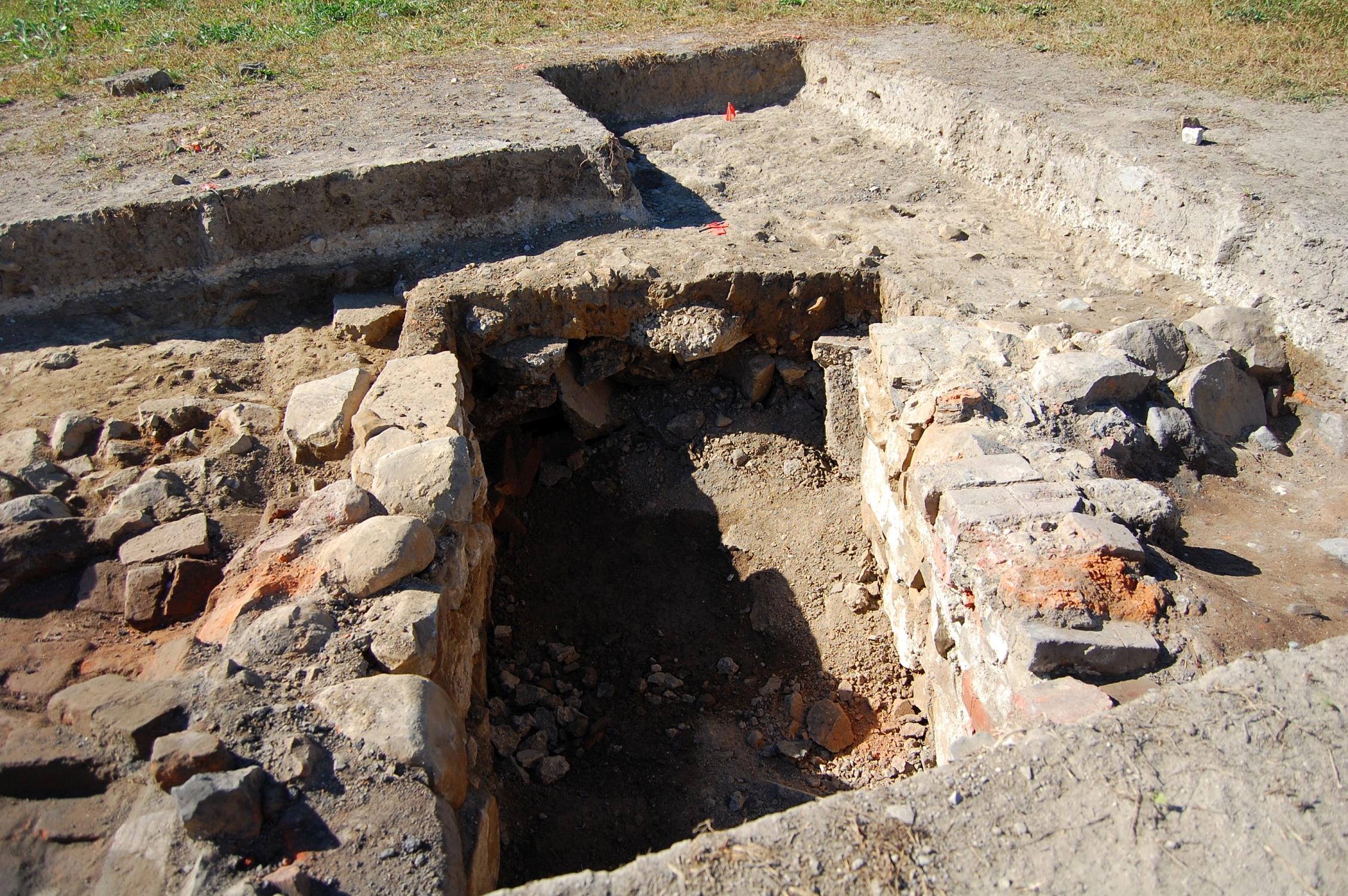
Today one of the reasons that the outward appearance of Russell Tavern is different from when George Washington visited in 1794 is because a fire “completely gutted” the house and some of the outbuildings on the morning of Sunday, March 25, 1917. The fire started in a defective flue. The Carey family escaped unharmed. The information on Russell Tavern comes from the following files at the Adams County Historical Society: Russell Tavern File, Russell Family File. Carey Family File. This image was taken facing northeast at approximately 12:00 PM on Sunday, June 16, 2024.
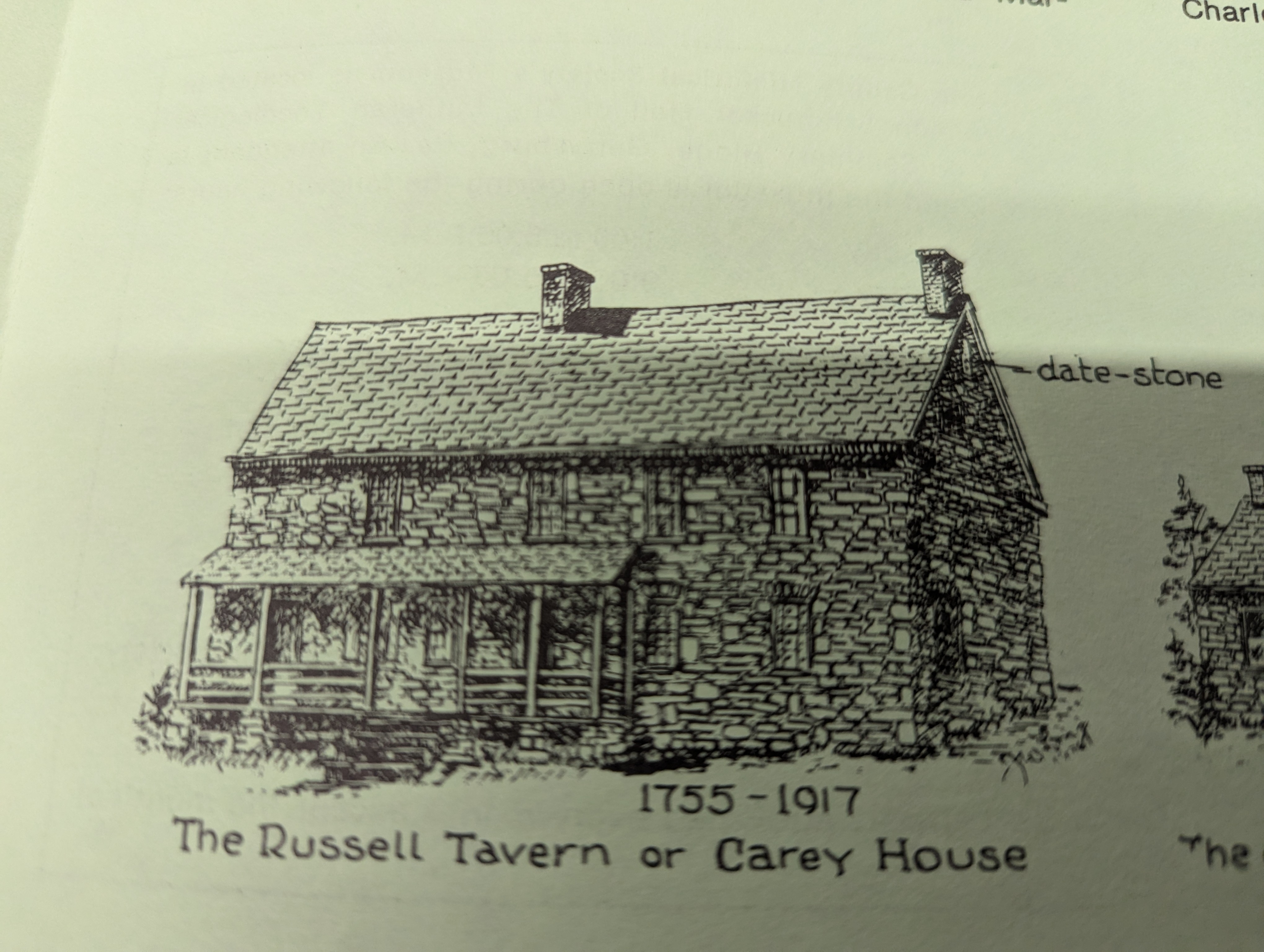
Before the fire, the house used to have the date stone at the top right of the house (gable), and four windows on the second floor. There was a chimney near the center of the house and a small front porch. There were the stone gables. This image was drawn by Adams County Historical Society volunteer J. William Long in 1976. The drawing was presented in the Adams County Historical Society newsletter of March, 1977.
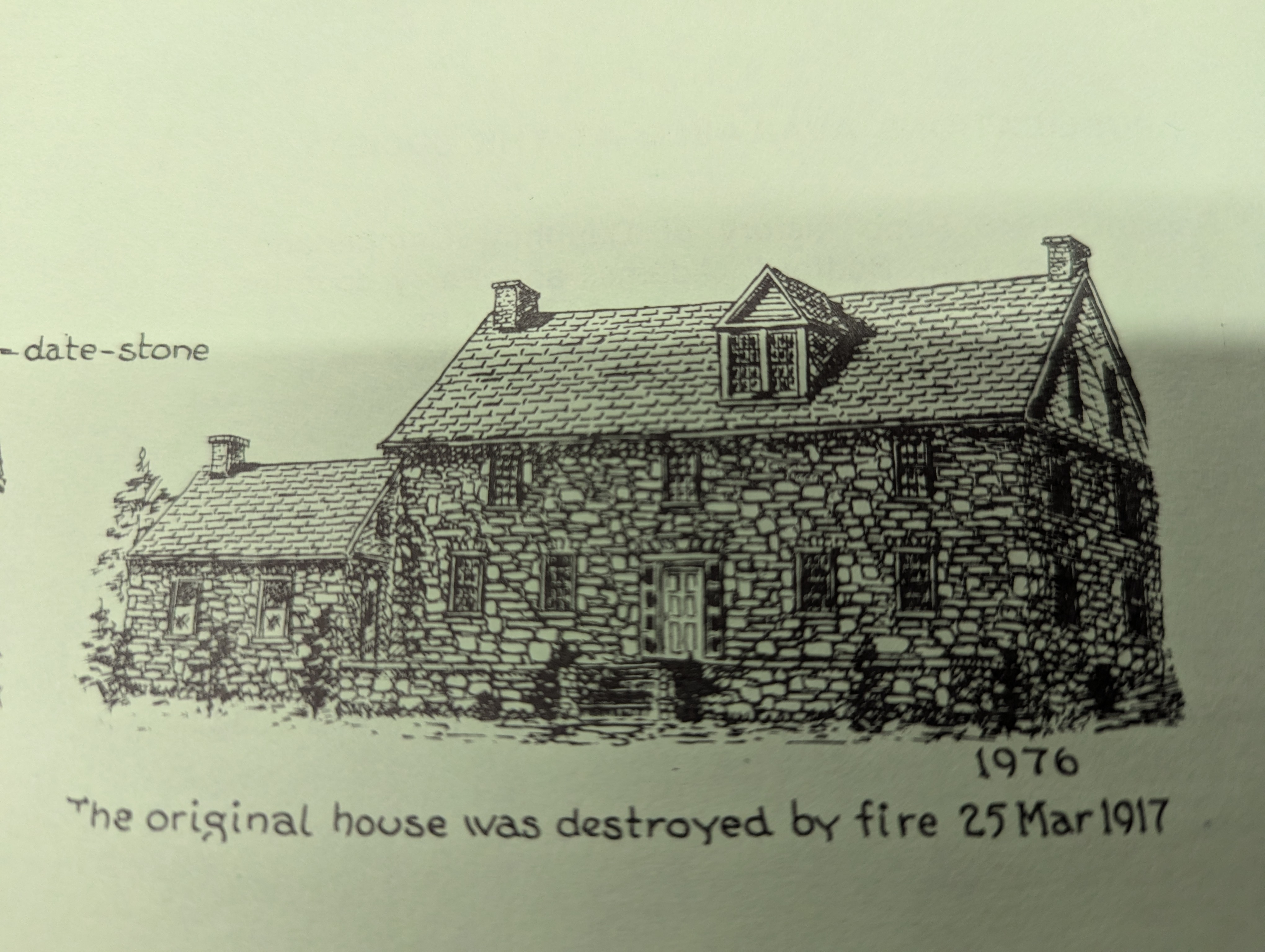
When the house was rebuilt after the fire, the center chimney was moved to the left/west. The roof was raised. The stone gables were replaced by wooden gables. The stones from the gables were used to build a small kitchen on the left/west. Dormers were added on this south side of the house and on the north side of the house. The front porch was removed. The date stone was removed and its location is not known. There are now three windows on the second floor. This image was drawn by Adams County Historical Society volunteer J. William Long in 1976. The drawing was presented in the Adams County Historical Society newsletter of March, 1977.
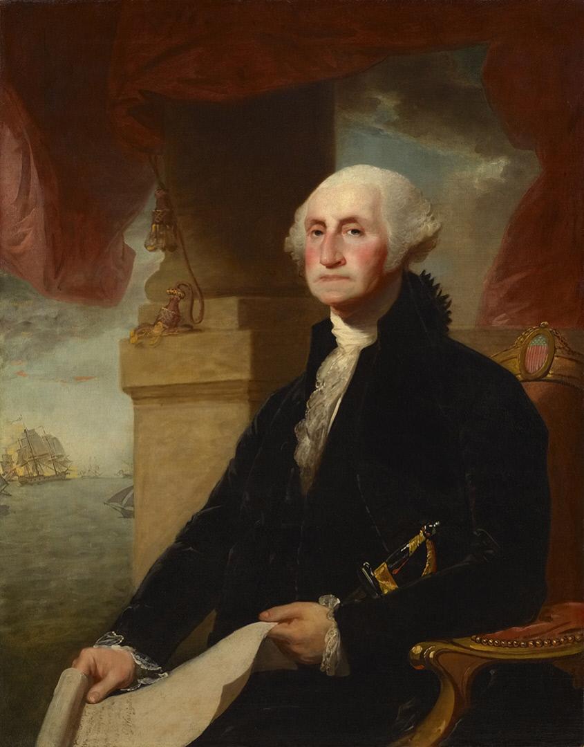
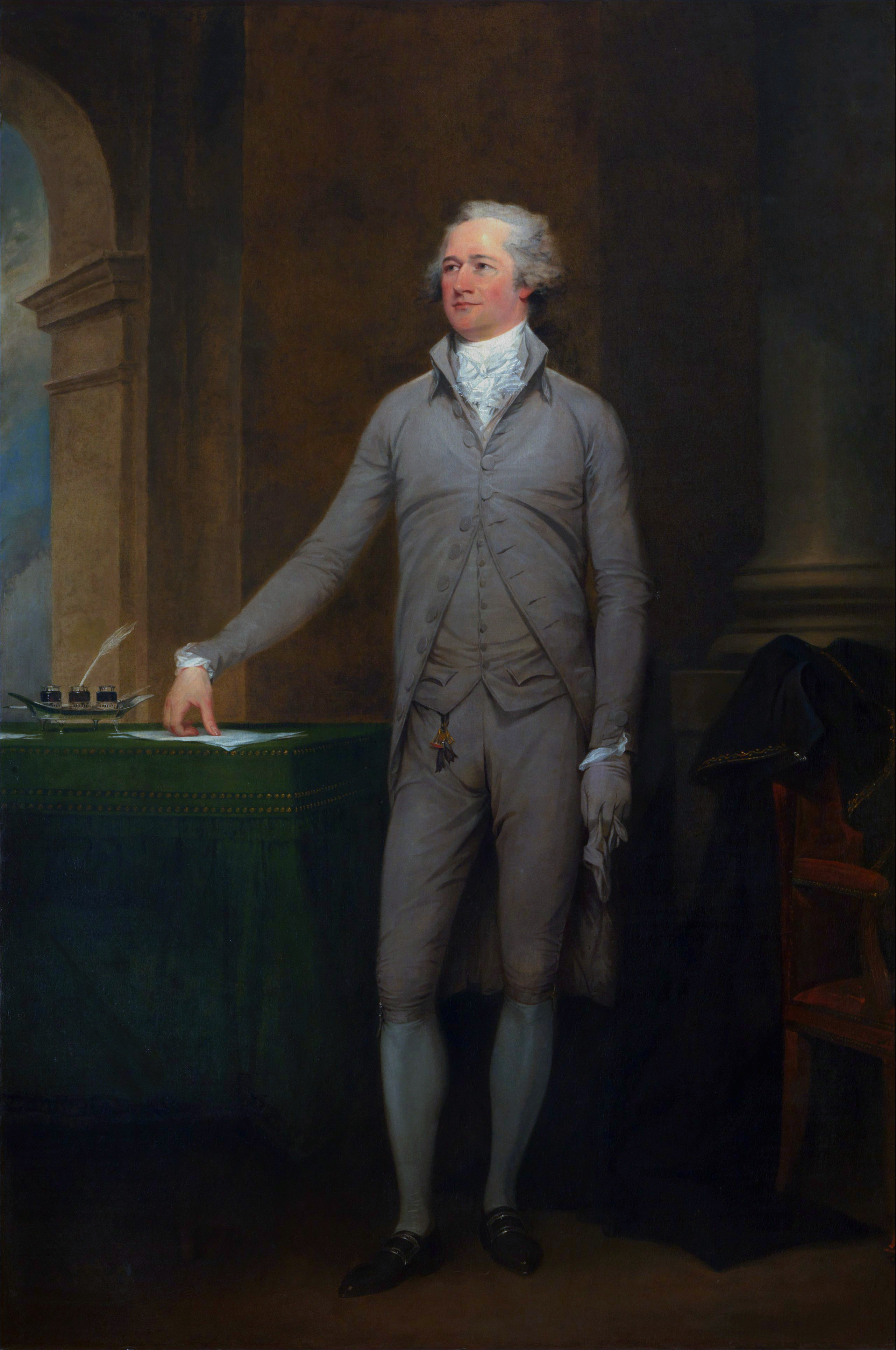
President George Washington (1732-1799) made Russell Tavern famous, but we hopefully in future posts we will study other family members with interesting stories, including... This image is known as the Constable-Hamilton Portrait. It was created in 1797 by Gilbert Stuart (1755-1828). It is courtesy of the Crystal Bridges Museum of American Art and of Wikimedia Commons.
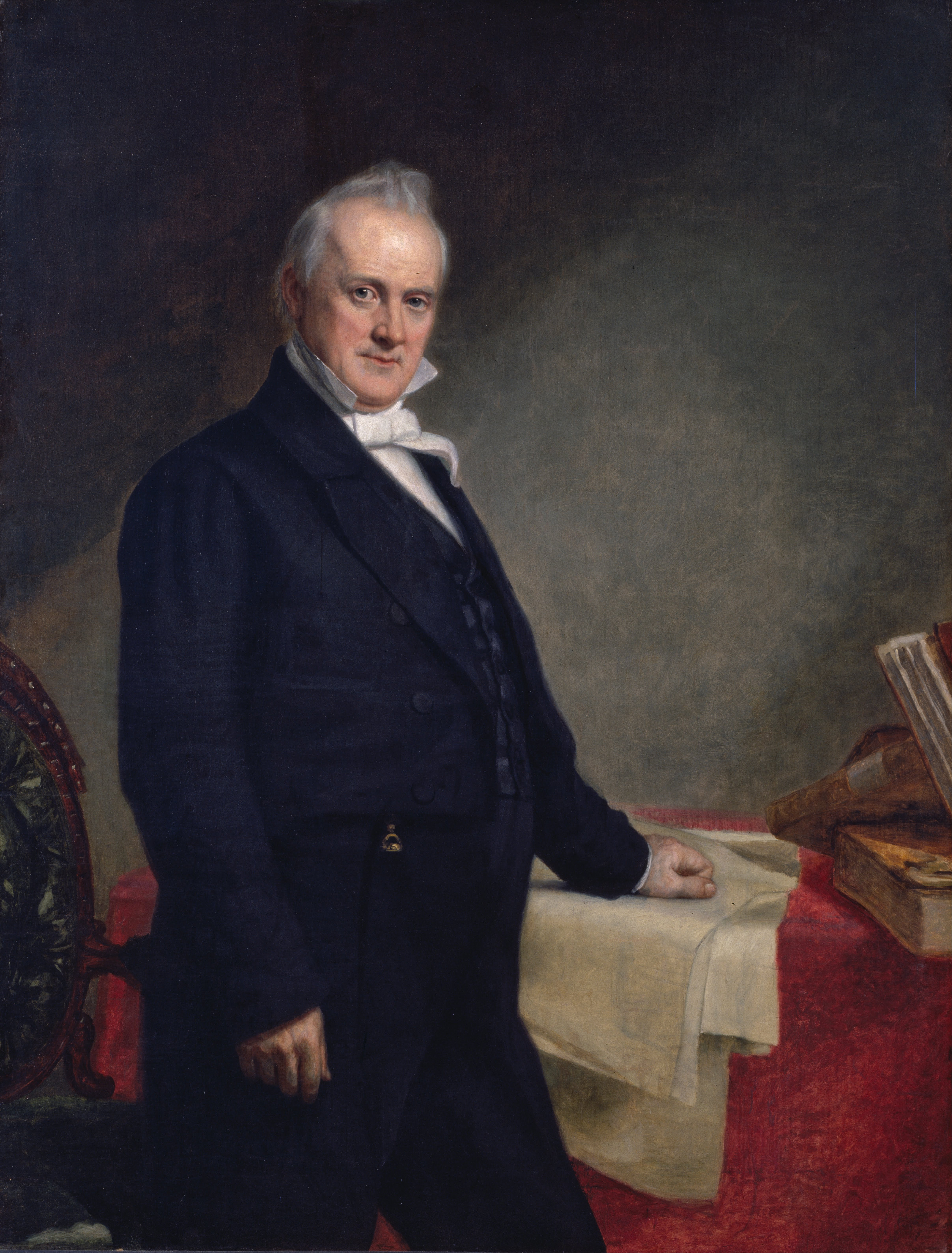
James Buchanan Sr. (1794-1821) the father of 15th President James Buchanan Jr. (1791-1868). James Buchanan Sr.’s uncle was Joshua Russell, the first owner of Russell Tavern. James Buchanan Sr. lived at Russell Tavern for a time. This image shows President James Buchanan Jr. (1791-1868). This painting was created in 1859 by George Peter Alexander Healy (1813-1894). It is courtesy of the National Portrait Gallery and of Wikimedia Commons.
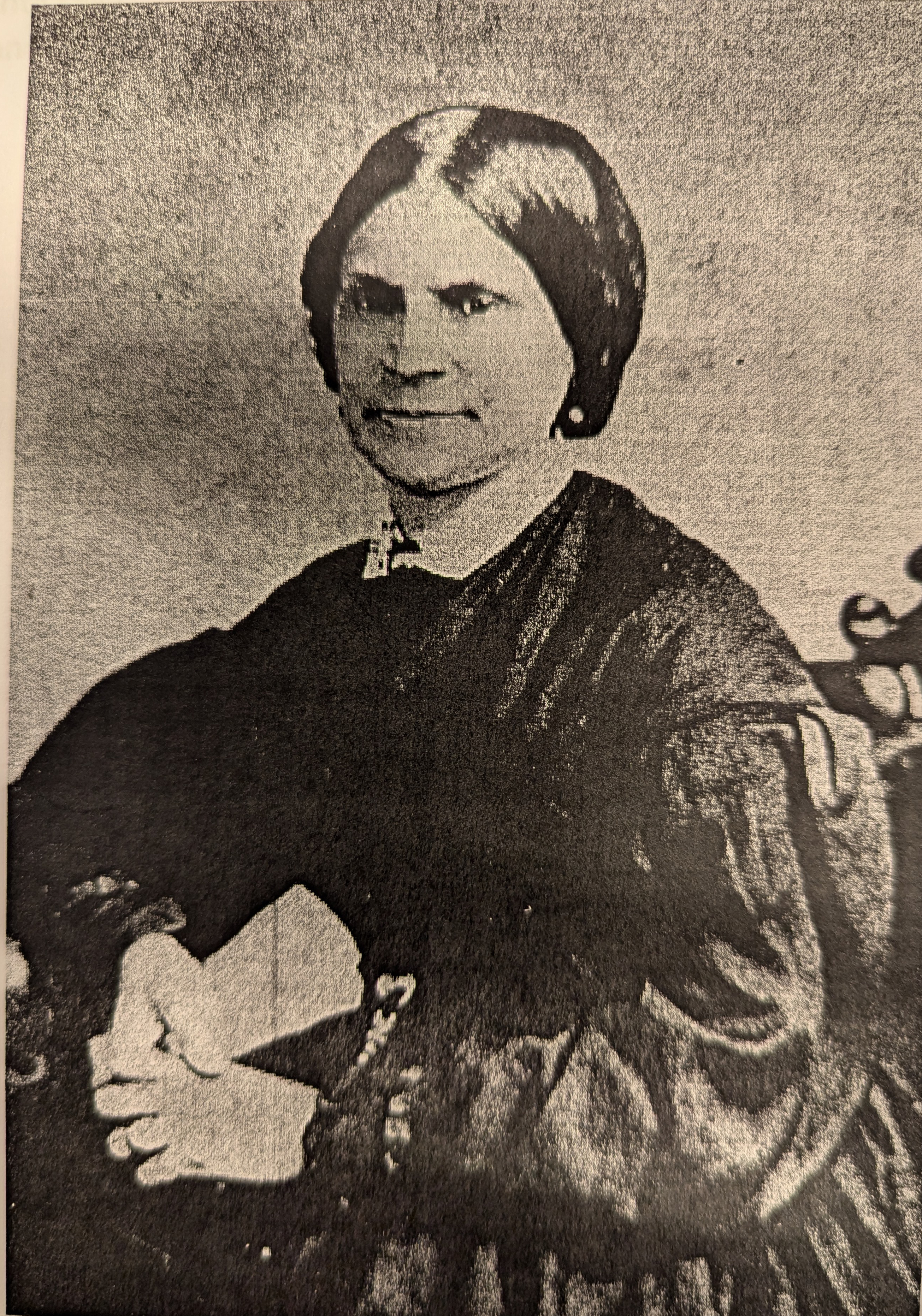
Another interesting resident of Russell Tavern was Lydia Hamilton Smith (circa 1814-1884), the “housekeeper” of Congressman Thaddeus Stevens (1792-1868). This photograph was taken by an unknown photographer circa 1868. It is from the Lydia Hamilton Smith folder at the Adams County Historical Society.
The post Russell Tavern and George Washington October, 1794 appeared first on Gettysburg Daily.
]]>


