Hanna - Infrared satellite
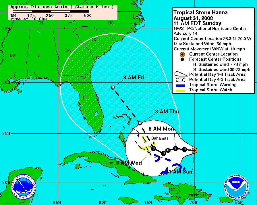
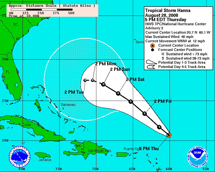
Considering the near stationary motion and relatively high shear in the short term, strengthening seems unlikely. I'm actually going to go against the National Hurricane Center in this forecast and predict Hanna to weaken to a strong tropical storm at some point tomorrow due to the mixing of the cold water from below.
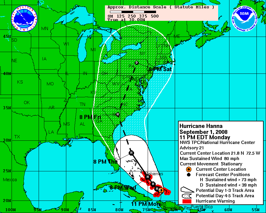
Hanna - Watches and Warnings
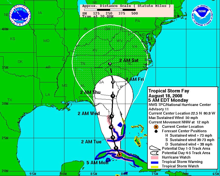
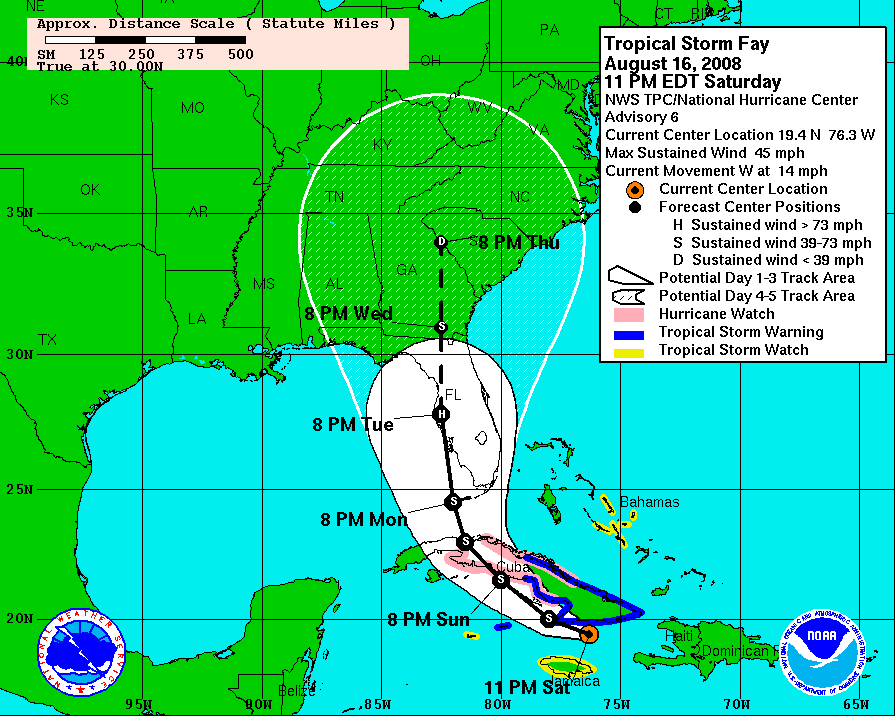
NHC also recently commented that the model tracks look surprisingly well clustered at this time. I don't know what model tracks they have been looking at, but they are not the same ones that I am seeing! The models are calling for landfall anywhere from Havana to Cape Hatteras! At this point anyone with interests from Cocoa, FL to the Outer Banks, NC should continue to monitor Hanna closely. Given the proximity of Hanna to the Gulf Stream, it seems likely that Hanna will maintain her strength or strengthen in her final approach to shore... no matter what her strength at that time.
To see all the models and charts for Hurricane Gustav, check out the Hanna charts page.

Hanna - Track Forecast

Hanna - Wind Speed Forecast
Elsewhere in the Atlantic, Tropical Storm Ike is looking like an unimpressive storm still slowly moving toward the western Atlantic. Fortunately for us, we still have a long time to watch the storm. Gradual intensification seems likely, but without a landmass in the way Ike will likely remain a spatially compact storm in the short to medium term.
 br>Ike - Infrared satellite
Ike currently is packing maximum sustained winds of 50 mph, but gradual strengthening is likely over the next couple of days. However, we have little to go by in making this forecast other than climatological norms.
To see all the models and charts for Tropical Storm Ike, check out the Ike charts page.
Ike - Watches and Warnings

Ike - Track Forecast

Ike - Wind Speed Forecast